Saturday, September 28, 2019

Eco Challenge Fiji 2019 - The World's Toughest Race


We're currently under NDA, so not much can be said about this race.  We had an experience of a lifetime though, through the scenic Fiji islands, jungles, rivers and oceans, to the interactions with the friendliest local people.  This race was produced by Mark Burnett, in conjunction with Amazon Prime and MGM, and hosted by Bear Grylls.  It should air sometime in the first half of next year, 2020.  Stay tuned...


Team Canyoneros - Steven Geer (left), Lena McKnight, Greg Watson, Nathan Whitaker, Hien Nguyen


Tuesday, July 9, 2019

Sheriff - Nocturnal AR - Elite 12hr


Nocturnal AR
7/6-7/7-2019

Lately our weekend training has been anywhere between 6-15hrs long and on several occasions, overnight.  The Nocturnal AR was just another training weekend with the way things have been going :D

For this race, the goal was to give Nate some more night-time navigation experience, use single-sided canoe paddles during the canoeing portion (where we normally use the faster double-sided kayak paddles), outfit ourselves with larger expedition-sized backpacks with some extra weight in there, test some new shoes, and continually work on good habits and efficiency.

So during pre-race, Nate took the maps and started pre-planning our routes immediately.  The race was broken into three simple segments--run, paddle, bike.  The canoe section was a little trickier, esp. at night, so he decided to let me take that one.  I was only able to look over his trekking route and it looked good.  I didn't bother looking at his biking route, cuz I wanted to have him learn through trial-by-fire if it wasn't optimal, but he often comes up with some really efficient routes that I don't see during the frantic pre-race moments.


Trek

The race started with a relatively short running section that had us finding eight control points (CPs) on our way to a river.  We joined forces with all of the Elite teams to find the first few CPs.  Night time navigation can be really tricky because you can't see far.  As the pack started separating, we started getting in our zone of calling out every terrain feature and pace count so that the navigator can confirm positioning on map.


There was a full search party at CP6, but CP7 was the one that gave us the first big trouble.  From CP6, we dialed in our compass and tried walking in a straight line for over 250m in the thick woods at night.  We didn't nail it the first time, so we decided to go back on the yellow-dotted trail, south of us, find another attack point (in this case the highest point of the trail) and then shoot another bearing back in, but this time be more mindful of staying as straight as we could.  The night is all about the technicals of pace counting and staying slow and sharp.


Paddle

The end of the running section led us to the beginning of the canoeing section.  Equipped with canoe paddles, we spent a few minutes dialing in our technique and feeling out the awkwardness.  With three people, there would always be one guy paddling on one side by himself, causing the boat to veer more to one side, but we made sure to keep flipping sides on cue.  It was definitely slower going but I'm sure that was because we aren't fully proficient yet.  On top of that, it was dark and Nate (the steerer in the back), couldn't really see ahead well enough to make the steering corrections himself and completely relied on Greg's full-time communication job in the front of the canoe to keep us as straight as we could, given the circumstances.

The river was quite 'overgrown' with sea grass and lily pads.  At times we just paddled right through the middle of it using V8 power.  Craig Sheriff, the race director, noted that you just had to follow his reflector markers on the river, and that was enough to allow locating the CPs fairly straightforward.  That and he eliminated five controls to shorten the paddling section so we could have more time for biking section.

At some point on our return route, we floated over a log that wedged tightly under the center of our canoe, not allowing us to go anywhere.  We've been there many times before so we started the protocol of shimmy'ing and rocking the canoe back and forth in unison.  After several minutes of being badly stuck, we upped the vigor and it finally start moving off of the log.  With more strength comes less control and you know how this ends, haha.  This log was spring loaded.  As soon as enough of the canoe dislodged itself, we immediately dunked over into the river and capsized the boat!

In the dark, in a river full of croaking frogs and who knows what else lurked, the only thought that crossed our minds was, "please don't let there be an alligator under us."  As we swam our canoe over to an island in the middle of the river, there was this nasty warm, chunky muck that enveloped our entire lower body.  It was the quick sand of the swamp, slowly sucking us down under and emitting thick burps of foul smelling sewage.  Nate had accidentally gulped some of this gritty stew and started gagging this demon out.

There was too much water in our canoe to continue on.  We had to beach this thing in the tiny little space we had on shore, with little solid footing to support our progress towards it.  Closer and closer, we finally grabbed a few overhanging branches and pulled ourselves up and the canoe in.  Our pant pockets, shoes and socks were filled with this swamp diarrhea.  Defeated, we flipped and poured the water out of the canoe and continued on, laughing at the reality and comedy of the situation.

That wasn't the only event.  My headlamp battery, a high powered Chinese Ebay knock-off that was encased in a mere piece of paper cover, shorted out during that ordeal.  Greg promptly gave me the only backup battery we all had, but then that shorted out instantly too!  From there on out, Nate was my headlamp from behind for me to read the map.


Bike

We switched to bike at the Main TA (transition area) after finishing the paddling segment of the race.  Luckily I kept a spare headlamp in my gear bin here and was able to swap it out and see clearly again.  Two teams left ahead on the biking section some 10-20 minutes ahead of us, but we needed to refuel here.  No one ate on the paddling section because of how much more coordinated we had to be as a team while using single-bladed canoe paddles...in the night.


All of a sudden Nate returned the maps to me and said he wasn't feeling up to navigating this section.  I took it and treated this like an FLO orienteering event, where you only get to see the map when you start the race.  I didn't even know what the route looked like.  I just trusted Nate's highlighted route and took it one control at a time.  I turned on the navigational after-burners during this section of the race.  The guys did an awesome job as usual calling out all the technical metrics and observations, while finding the controls with some kind of x-ray vision.  I just had to make sure what they said lined up with the map, which resulted in a near flawless execution of the plan.  When things go flawlessly, there isn't much drama or story to tell.  I don't really recall anything outstanding in our story here, which is probably a good thing?  Well, there was a bike bushwhack to get bonus CPs 15-16-18.  That was pretty fun.  And oh yea...Nate's headlamp battery shorted out too lol.


Conclusion

With everything said and done, we finished the race in about 10hrs and 40min.  We made up significant grounds on that biking section and took 1st overall.  With our stories of capsizing and headlamps dying on us, Craig decided we earned the "Tough Break" award too lol.


Sunday, May 19, 2019

ARGeorgia - Blue Ridge AR - Elite 24hr


With every race, we're trying new things, like gear and focusing on practicing good habits.  So to hit us hard with sleep deprivation (we didn't really have much of a choice on this one), we did a full shift at work, took an hour or two nap, drove up to Blue Ridge (~9hrs) while taking turns sleeping and driving, raced the 24hrs, took a bath using a sink, then drove home taking turns again.  Well, I contributed 30min to that :)


team EA Sports - Canyoneros - Hien Nguyen (left), Nate Whitaker, Greg Watson


After being bused to another location, we started the race by crossing a river at a shallow area to collect four CPs (control points).


Our plan was to collect all of the controls in clockwise order and then trek over a mountain to loop ourselves back to the start.  We had numerous teams warn us against going over the mountain due to the thick and thorny vegetation up there, so we decided to listen and re-route our finish.  While returning to the start, we found ourselves at a deeper section of the river and had to fully swim across.


The next leg was a short paddling section that had us go through some whitewater.  Greg did a superb job of communicating a clean line for us to traverse through rapids, where we found ourselves leaping ahead of several teams.  However, one area was rockier with a bigger drop-off, so as we fell down the steps of the rapids, our canoe filled almost completely with water and we got stuck and so did our Florida Team Disoriented, but we worked together and got ourselves out safely.

adventure racers joking and laughing it off after mishaps


This race was billed to have expedition-like navigation and elements by the race organizer, Jeff Leininger, and indeed it did have some tough CPs in the night where route choices were key at times and physicality was brutal with the mountain climbs.

During the middle of night, we got yelled and cursed at, non-stop, by a local who frantically got out of his truck on the side of a road.  We were merely walking on a public road near where he parked.  At this particular moment, we were trekking with Team Disoriented and I can see how the dude would have been immediately scared by 6 headlamps trekking his way, shining lights on him as we looked around, but after a few apologies and explanations, I couldn't understand why he would continue to yap and threaten to "blow us" away.  What was he hiding or doing before we got there?  We'll never know, but it's fun to laugh at guesses.

We cleared the course up until the last two legs, where we just chose to gather the three best bang-for-the-buck controls on each leg.  This turned out to be our best choice after evaluating the state of the team at the moment and then confirming after talking to a few strong teams who cleared or attempted to clear one of the legs.  There was some really fun single track biking trails we took on the way back to the finish, while collecting CPs.

my favorite area was the climb up a steep and slippery mountain side to witness a majestic waterfall

We finished the race around the 23hr and 30min mark, pushing our bikes up Aska Road in some intense heat for Georgia at this time of the year.  I don't know where we placed overall out of 32 teams in the end, as speed and competition hasn't been our focus as of late, but long enduring events to beat the body into adaptation.  We left early and didn't stay for the post-awards show, but we got 4th in our open division.

Thanks Jeff for helping us continue to build our team for what awaits and throwing a heck of an event!


Thursday, May 9, 2019

FLX - Howl at the Moon AR - Elite 12hr


Johnathon Dickinson State Park, Hobe Sound, May 4th 2019
author - Nate Whitaker


Introduction
Canyoneros are currently training for a multi-day expedition race that takes place later this year. As part of our training, we’ve been trying to participate in a race or long training day every weekend. This weekend Greg, Hien and I found ourselves driving to South Florida to compete in the Howl At The Moon Nocturnal race. This race would be a challenge for me as Hien was handing me the navigation reigns so that I could improve as our team's #2 navigator. Needless to say, I didn’t expect us to be as competitive as usual and my teammates all agreed that the focus of the race should be training and good habits.


Pre-race
After a much needed detour to Arby’s we arrived at the event later than the other teams. Teams were already furiously working the maps, plotting and measuring, as we unloaded Greg's truck. All of the tables were taken and we set up a base camp outside of the rest room (luckily the smell wasn’t too bad).  Clouds were starting to form overhead and the distant sound of thunder was noted but it was still very bright and hot that afternoon.

We checked in and Ron handed us maps for the first trek and paddle legs. As I sat down to plot our route, my teammates started getting all our gear race ready. The first thing I noted on the maps was that all measurements were in miles. I prefer to work in km so did a quick conversion for the distances that I felt mattered.
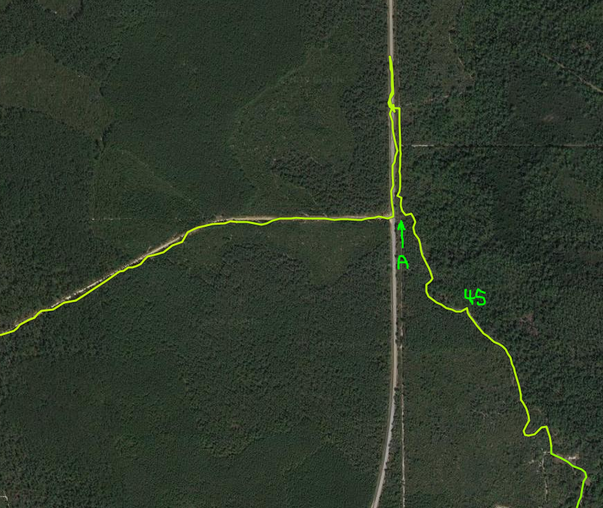


Trek 1
Disclaimer, my route was far from optimal but here is what I plotted. Everything looked straight forward on paper and it even looked like we would have a nice river swim to end the trek leg.


Once the race started, we all ran out the gates and our team broke left whilst the other lead team (Jason) took a more northerly route. I looked to see if anyone was running the same route as us and only saw one team following us. Everyone else was running the same route as Jason. Still, not to get discouraged, I had a plan and I kept to it. My team mates never questioned my decision and commented that “cool, we like to run alone anyway”.

We found every CP with ease up until CP3. We attacked at where I thought the CP was but didn’t find anything so figured it was the wrong trail. I questioned whether I had switched to mile measurements subconsciously and had blown my pace count. We decided to run north until we found an intersection and then come back south with a new pace count and attack again. Sure enough, it took us back to the same trail. This time however, I did not turn around after 100m and kept going forwards, sure enough the CP was right by a creek, tucked behind a tree, approximately 5m from where we’d turned around previously. Oh well, shrug it off, that’s 10 minutes we won’t get back.

We then continued further north until CP4 and started pace counting to where we thought the CP was. We then all scoured the area and came up with nothing! Again, I backtracked to an intersection and remeasured whilst Hien and Greg kept up the search. I then reattacked and…nothing… After some time, team Nature Calls turned up and I explained that the CP was a nightmare to find. Of course, Manny then runs to the same point we were looking and then pointed out the CP tucked behind the one tree, right on the trail, that we never checked. Are you kidding me? Oh well, that’s another ten minutes we won’t get back.

The rest of the course went well, we hit every CP first time and then at CP8, went for what we thought was a river swim but were now expecting a simple wade through a creek (when we had seen Manny he had mentioned that he had took a shortcut over the creek but it was only a few meters and waist deep). We had been looking forward to swimming with full gear so we were disappointed. Regardless we followed the trail east until it ended and then we stumbled upon the creek.  We were delighted that it was an actual river, maybe 25m wide, deep and by that time, it was night.  Team Control’d KAOS met up with us at this point and we all swam over together then hiked another couple of hundred meters through a very dense swamp. We all loved it, this is what Adventure Racing is all about!

Once we broke through the swamp, team Control’d KAOS broke North to CP1, and we heading back to the TA having collected all CP’s. In retrospect, team Control’d KAOS had chosen a route that would have shed several km from our run had we done the same. Lesson learned, spend more time on route choice next time I have the helm…


Camp Murphy Maze
When we got to the TA to start bike, Ron was talking on the phone to a team Good Nuff who were already at Camp Murphy and had started that leg going for the closest CP (Bike CP 5). They were having major problems finding it and right after Ron stopped talking to them, he started advising teams to start at Bike CP 1. The CP’s on this leg were laid out in such a way that one CP contained clues, and or adjustments, for the “actual” location of the following CP. The plan was teams were going to attack them in order but Good Nuff had done the logical thing, that we were also ABOUT to do, and attacked the closest first. We then headed to Camp Murphy with this new intel and followed the route in order. I felt bad for Good Nuff as it must have cost them so much time without that information.

Once we arrived at Murphy, we started following the CP’s in order and also had a lot of fun riding the technical trails. In some places where there were obvious short cuts, we elected to ride the trails instead, whilst commenting that it would be great to come back to the park again some day.


Trek 2 – “The Dunes Of Hell”
We rode to the remote TA at hells gate, and were immediately tasked with plotting UTM Coordinates onto a tiny map. Hien and I plotted UTM’s whilst Greg, took care of our gear and resupplied us all. We then left the TA and I started to look at the route I was going to take then realized I had a major issue, I couldn’t read the map! I recently had ASA corrective eye surgery which comes with a 6-12 week recovery period in which your vision jumps around and gradually corrects to 20-20. The scale of the map resulted in me seeing a blurry mess and not being able to pickup contours at all. Hien graciously took over this leg and we headed out.


Nate comment:- the “Dunes Of Hell” certainly lived up to their name and gave many teams fits trying to find the controls (no single team found all controls but all controls were found, if that makes sense).  Many teams were visibly frustrated as this was an intense mental and physical slog. At one point, Greg sensed that the Dunes were about to get to us too and started joking about them. We continued the joking for hours after and the Dunes actually became fun! That in a nutshell is why I love our team, we can turn around any lousy situation and make it fun. Embrace the suck!

imagine trying to find this control box deep in the woods at night, without clues


Paddle 1
After the “Dunes Of Hell”, we rode back to the main TA and transitioned to paddle. Ron had advised us that we should count on doing the family leg if we wished to achieve best “bang per buck” in terms of time vs CP’s (there were 9 of them on this leg). As such, I measured a route that would collect us 3 out of the 6 CP’s and we headed out. This leg went better than I expected, I had dreaded this leg the most as I was having issues with the scale of the topo map on the river, and my corrected eyes. Also, the river map didn’t always seem to match reality. However, I relied on a turn by turn method of navigation and except for us overshooting CP 1, which we then grabbed on the way back, this leg went well.


Family Course
We’d set aside an hour to clear this three-discipline course and we did so with ease, we then headed back to the TA and punched in to finish, or so we thought…Ron had other plans…

Ron has been extremely supportive in giving us advice for our expedition race later in the year, whether that advice be training, equipment or providing us with useful contacts. Ron then told us to grab some water, have a little rest and then go out and collect the 1st trek controls on bike. We grabbed them all using pretty much the same route we’d took on the trek leg except we avoided the river swim which, we probably should have tried with the bikes.


Once we paddled back to the TA, Ron was out collecting controls and everyone else had gone home. We left the controls we’d picked up and then packed up and hit the road. About twenty minutes into our journey back to Orlando, Hien got a text from Ron, “Pickup Paddle controls 1 – 6 next”. Unfortunately, we didn’t get the text whilst we were in the park, and still in race clothes, otherwise we would have done that too. Thanks again to Ron, and a huge thanks for not making us pick up the controls in the “Dunes Of Hell”. Ron did that himself and in good old Ron fashioned, seemed to love it!


Conclusion
This was an enjoyable race, in a great park and we thoroughly enjoyed the training. We were pleasantly surprised to see that we actually got second place too.


Darn Tough Socks
For the last couple of months, on our long training days, I’ve been experimenting with foot care solutions. Whether that be tape, socks, liners etc. None of the solutions I’d tried so far had seemed to eliminate blisters completely. Prior to racing Nationals a couple of years ago, Darn Tough had handed me a pair of socks and I had remembered them as being super comfortable but also good on the feet.
With that in mind, I’d reached out to Darn Tough and asked if they would send a pair to try before our expedition race. The super generous, nice folks at Darn Tough promptly replied and asked our  teams shoe size. They then sent our team a couple of pairs each to try.

For this race, I covered my toes in Run-Goo then out on a “Hiker Micro Cushion Crew” sock. The verdict:- this sock was awesome, despite us being wet for pretty much the entire race, thanks to that Trek 1 river swim, I peeled off the sock and had zero blisters!

We are racing (well training) at the 24 Hour Blue Ridge Adventure Race next week and I plan the wear the socks again. Thanks again Darn Tough!


Tuesday, April 30, 2019

Sheriff - Earth Day AR - Elite 18hr

We got a big multi-day race later this year in September, so we've started ramping up our training last month again.  Earth Day AR was a nice long race where we could iron out a few things and enjoy the some night CP hunting.


Trek 1
The race started with a choice of running or biking, so we chose running.  We took a clock-wise approach to this route, starting with CP22 and ending with the far CP25.  Not too much drama to this section, except going from CP22 to 17, which I thought had some trails leading to it with the way the map was illustrated.  It did not in real life, so we carved our own trail to 17 (green circle in map below).  Nate was always bang-on with his CP sniffing.  He's been involving himself much more when it comes to navigation, which always helps offload some of my work and improves our accuracy with double-checking.  Both Greg and Nate were always great at helping me spot distinctive features in the field to help us confirm our positioning on map--things such as topology, faint trails, vegetation changes, etc.  These are very crucial things to do as a team, as the race goes on and my mind gets a little more dazzled.


can never avoid bushwhacking through palmettos in a FL race


Bike 1
I measured out every leg of this small biking section and it seemed to pay off pretty well, as some of them could have been pretty hard to nail sharply if you wing'd it.  We didn't have much issues here at all.


following a faint trail in a field of bushes

I think we're still on the trail

not sugar sand!

trying to find a CP off the trail


Trek 2 A/B
This was a very unique challenge of the race.  I started as the map commander, while Nate and Greg followed my directions on walkie-talkie to gather some controls in Juniper Springs Recreation Park.  Every control they visited had a set of UTM coordinates written on the checkpoint, which they would relay back to me to plot on map for their next control.  I just had them straight bushwhack from one to another on a few of them.

Once they picked up a handful of them, it was now my turn to go fetch some controls under their walkie-talkie instructions.  We had watched several Sport AR teams do this earlier in the day amidst some frustration, so we took it very step-by-step-like to keep it all slow and accurate.

Again, very interesting section that allowed us to rest and fuel up, and it adds more tools to our belt.


Paddle 1
There were only two controls on this paddle that took us 4.5hrs to complete.  I was able to turn my navigating mind off on this leg, and it was nice.  Greg did an awesome job communicating turns from the front as usual.

All I can think of was the middle seat for this section.  It took us about 12 minutes to attach the middle seat onto the canoe properly.  We met up with Team Disoriented here, where they gave us some tips on how to attach it.  The sun was coming down as we struggled to pilot the canoe through the narrow bends of the river with a 3-man setup.

The first time we side swiped a log in the middle of the river, the seat was literally kicked out from underneath me.  My ass instantly dropped to the floor of the canoe in a rude-awakening.  The seat, which took us so long to put on, was now so misplaced that Nate had to kick it multiple times to get it back in place.  The second time we brushed up on a corner after turning too late around a bend, my seat popped off again and rammed into Nate's shins.  This occurred so many times with our crazy maneuvering of the canoe that I don't know who was more traumatized--me and my falling into the floor of the canoe or Nate and his skin-scraped shins.  Every brush we passed by was seemingly just low enough to grab a hold of the center seat and pop it off underneath me.

our recorded GPS route

Once we got out to the giant Lake George that the St. Johns River flows through, we pushed hard against the current.  It was fully nightfall by that time and as I looked out into the vast lake and the distant port lights, I was envisioning what paddling in the ocean could be like--quite surreal.

As we neared the finish of the paddling portion, there were a bunch of boats just fishing and chilling in the channel that lead to the Boat TA.  Looked like they were just having a chill time, living the life of relaxation deep into the night.


Trek 3
This was a fairly straightforward leg that had us collecting two controls on route to the next transition area.  I had one mistake here after picking up CP45 and heading west, but in all fairness, the map had a connecting trail at (A) that we never saw in real life.  I should have counted paces here to perhaps bushwhack through across the road, but I didn't and we ran much further than we needed to.


Bike 2
This section had several control points that were located on the perimeter of a pond that was deep in the woods.  We loved it.  There was one pond that had so much life in it, you heard all types of loud frogs, crickets, alligators and who knows what else lurked beneath the surface of the nightly marsh.

There was another pond we had to find where we overshot it on the trail by about 120m.  After trekking into the woods about the distance needed to land on top of the pond and not seeing any hints of a pond (marshy grass, a clearing, etc), we used our hearing senses to hone in on the nocturnal frogs.  It was an incredible method that led us precisely to the CP.


Much of the controls on here were on pretty nice single track trails or hard gravel.  It was rather cool and pleasant for most of it.

I don't know how Craig, the race director, finds some of these controls, but the "illegal house" was very creepy, almost witchcraft-like, deep in the woods, in the night.  It was also one of those where it could have been really tough to find in the night too, but we found it almost on first try.


On the way back to the finish, I couldn't find the mapped short route to the Main TA, so we took the FL Scenic Trail back, which added 7min to the route.


Conclusion
We finished the race in 15hrs 40min after finding all but 1 control point, the 'hunter's stand' that we found the wrong one at (CP46).  Much easier to find in the daylight, I suppose.  We ended up 2nd in the Open Division.  We didn't stay for the awards, but that might have been 3rd overall, behind the speedy "Team Disoriented" and friendly "All Toe-Nails Go to Heaven".

We got a few back to back to races coming up and I feel the team is getting back into business again.  Much thanks to everyone who helped put this race on!