"Guys, it's back again," Greg Watson texted us a couple weeks before the race. "I've got kidney stones, I'm gonna have to pull out." Our resilient racer was shelved as he checked into the hospital twice in the last couple weeks. Nate and I went on understanding we would go as an unofficial two-man team at the National Championships. We emailed the race director about our latest status, and he sent us a couple racers who were looking for teammates. A day later, Dr. Drake White of Illinois quickly emailed us, eagerly wanting to join, knowing full well the uncertainties that come with it. His team had also been on the unfortunate end of mishaps and had to disband entirely. As he modestly described himself and his nine years of adventure racing experience through email, we knew someone like him would be the key to getting us even further. We were glad to get back into contention again.

The night before the race, we gathered together at the host hotel, checked in, dropped our bikes and paddling gear off at the Start, grabbed food, and drove east towards to the Savannah River to sit in on the pre-race meeting. It was a mad scramble to get everything done on time, in so many different locations. Our packet of race documents included a page describing the order of the race, which gave us some clues on where and how the route would work. This was great because last year, I had no good grasp of the general race route until the race was done with--I just didn't have enough time to plot and develop the plan during the morning.

Canyoneros - EA Sports
Nathan Whitaker (left), Hien Nguyen, Drake White

This year, we had a great plan of attack for map plotting that morning. Nate called out the UTM coordinates, Drake quickly plotted the control points and confirmed map feature with Nate's clue sheet, as I developed the route. It worked very efficiently.

Yes, every team's color coincidentally was orange (photo below). Just kidding :) It was hunting season and the race staff didn't want us to be accidentally shot, so teams either wore orange or a vest over their shirt.

The morning was crisp and cool. We had a prologue that carried us to 12 golf course holes. Since we were in Augusta, GA, a city that hosts the Master's Golf tournament each spring, I envisioned clear cut tree lines and a well manicured turf, just like the map illustrated. Nope, what we ran into was a seemingly abandoned and overgrown low budget golf course. The chaos of 60 teams running all over the place confused me a little and had me missing the first point I wanted to nail. That and the fact that the map was not oriented to north (as I found out afterwards). Anyways, once we found our first point, the rest were easy and quick going.


As we transitioned into canoeing, Drake took navigation in the center, as he claimed that was his strongest discipline (although Nate and I point to his biking ability, hands down). We had determined to collect the controls in a clockwise manner, starting with CP8 on a hilltop.


It was a beautiful paddle. The splash of the water was quite invigorating. Nate and I were conditioned in 100℉ degree weather down in Orlando, FL, so this 60℉ morning was an energizing treat. The red-tinged islands contrasted with the lush green trees as we passed them. Some of the shores had this dry and cracked ground to them that resembled a desert. Others had a rocky seashell-strewn floor with a hint of ocean smell. The variety of environments we ran across was truly scenic.


(photo above and below) There was a small area of land we portaged across to cut down on the distance that we had to paddle while going from CP1 to 3.


Two of the control points had us getting on land and running deeply inland to find the CP.


Once we finished this water section and paddled back to the boat launch, it was time to bike and collect three control points. I took nav back. The route had us going through technical biking sections, paved road, 4x4 dirt trails, acres of fallen trees, bike whacks through forestry, sideways/rocky single single track--you name it, it had it. We even had a country pitbull dog chase us for a good mile and a half. He was persistent and just as fast as us on on bike...while we were on paved road!


CP12 was also the location of a transition area to get on foot. We found CP13, 14, and 15 fairly easily (15 took two attempts). CP14 was found pretty creatively since a clear attack point wasn't very apparent to us enroute. Going east along the single track trail, we ran into a larger unmarked trail intersecting it, with a river channel to the east. We simply counted about 200m north and then cut west to find it.

Back at the transition area (CP12), we got back on bikes and headed back--in a circle in fact. I somehow led us in a loop back to the transition area since I thought I didn't really have to pay attention to navigation. Yea...demoralizing.

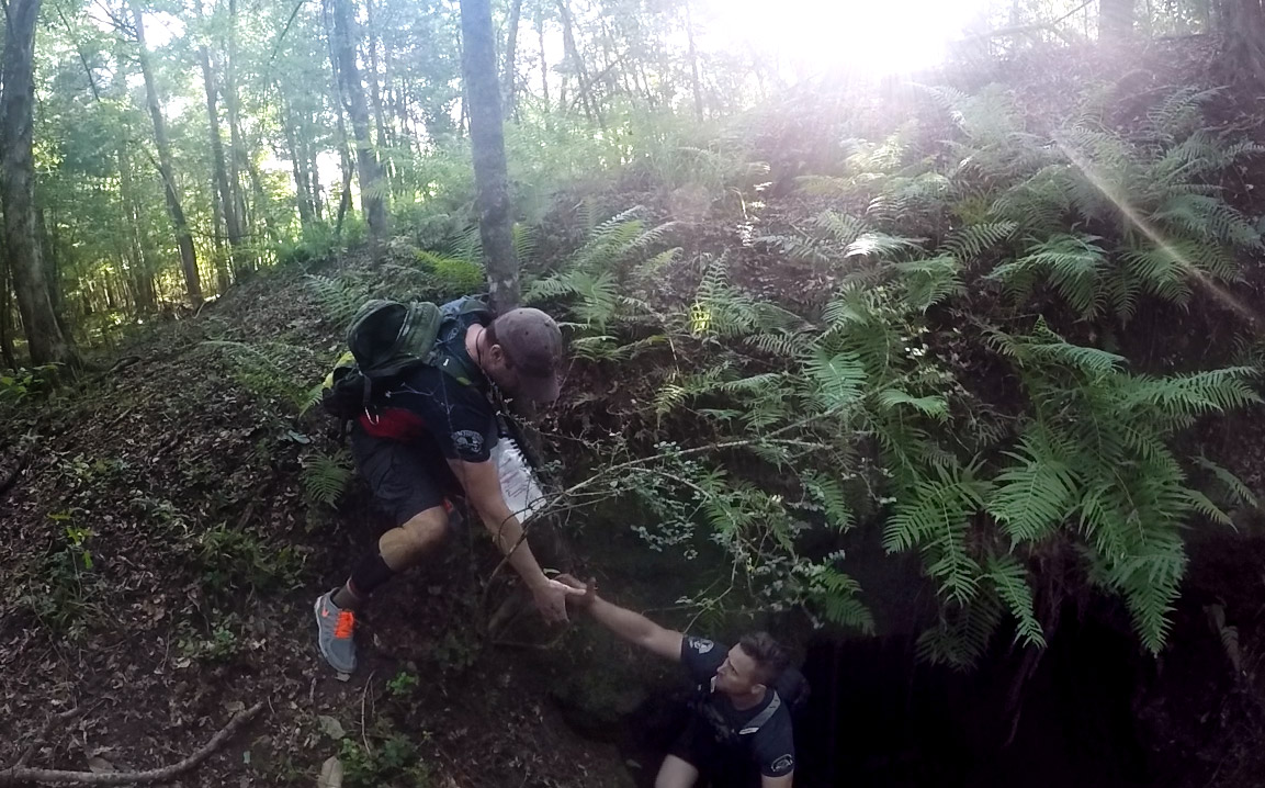
Nightfall came as we transitioned again to foot. The race had a whopping nine transitions. I suspected with Drake's experience and brains of a doctor (he is a doctor and surgeon), I had to hand him the navigation for this part. He traversed the land like a mountaineer as Nate and I backed him up on the technicals. Coming from FL, land of the flat, Nate and I relied more on the brute force of a straight bushwhack as our bread and butter. This worked pretty well until CP17 from 16, which we attempted a straight 650m bushwhack. The forest was thick, viney, and laced with thorns. We couldn't go straight. It was going to be a miracle to hit on first try. Sure enough, we didn't intersect it, so we ended up bailing out on the road and shooting back in from the lowest point of the road.
As we gathered the eastern controls, Drake was getting confident on our sharpshooting ability, and we were very confident in his topographic reading of the map and land in the night. It was a profound synergy that fueled the rest of the orienteering sections as two navigation techniques fused together to become a greater one.

Once we cleared the six orienteering controls, we swapped to bikes and progressed east on the Bartram Trail. This trail was voted to be the most fun part of the race. The single track was fast and flowing, and did not force us on any hike-a-bikes. Earlier in the race, Nate was having some difficulty with the really technical sections on bike, but now he roared to life and led the charge into the next transition area in South Carolina. What? You thought nationals was just held in one state? Nope, we raced across two states! That's right. It was just pure enjoyment...until I made the biggest blunder of our race while in control of navigation. I totally overlooked CP22! We had to backtrack and lose 37min.
Across the border below Clarks Hill Dam, we had another orienteering section, which I gladly handed the maps back to Drake. We knew this would be the toughest section of the race on a navigational basis.
I recall how hairy the marsh was leading over to CP26 as he chose to start off by following the power lines. Looking down into the entrance of this unknown path from the road, it was like a giant ditch that led into the dark abyss. You couldn't tell if you were going to sink into the murky marsh, overgrown with tall wild plants. But we followed him in, carefully prodding our legs in between any open gaps of invasive thorny bush. The grassy marsh below got more and more wet as I braced for a nasty swamp whack. Within a couple hundred meters, the ground started rising again and we were back on dry grounds, albeit still overgrown with vegetation. As soon as Drake identified the high point along the power lines, we shot in and out for the control. We continued to rely on each other's strengths to navigate this slowly, steadily, and most importantly, accurately. At times we were on our hands and knees, bushwhacking through tough, entangled brush.

In the morning, right before dawn, our paddling section started. It was still pitch dark. The water was smooth as glass. There was no sound to be heard except our paddles stirring the water. We were paddling down the Savannah River, the natural border between Georgia and South Carolina. Ten kilometers away, our first control point was to be found. I estimated we were going about 8 min per km and set our stopwatch for an hour and twenty to measure distance. It was monotony at its finest. It was that part of the race where no one spoke, as we tried hard to fight off sleep. This paddling leg was going to be perceptibly long.
As the sun cracked over the horizon and wet the canvas of the sky with her first brush strokes of saturated orange and navy blue, we slowly woke back up. I looked down at my stop watch and it showed only thirty minutes. We passed the time reminiscing on memorable races as we absorbed the serenity of the view. The end of the tree line to our left kept extending further and we could never reach the apex. Did I mention this paddle was long? It didn't help that our canoe had a strong tendency to veer to the left, which caused us to zigzag the entire way.


I didn't think my estimates were going to be exact across such a long length of distance, but at exactly an hour and twenty later, we found our first control point, which was under an outstanding bridge. The rest of the controls went by more interestingly. One was after a tight narrow channel, stashed deeply away in a bog; another was on a dam, and the last was at the transition area.


We had plenty of time left to finish the final bike leg of the race. I took nav again as Drake led the team and blasted down the Seaboard Coast Line at warp speed to find three CPs. One was under a bridge, the other was in a technical biking trail, and the third was on a bridge of a dam. The last one was quite tricky, as I had a really tough time figuring out the topo map compared to reality. Luckily Nate spotted another team up at the top of the dam, which we thought we would try. The scent was strong as Nate continued to sniff his way towards the control bag. It was indeed there.
Drake again, spooled up the turbo and unleashed afterburners as we thundered back to the finish line. My quads were on fire but they kept revving at redline like Formula One pistons. We finished the race clocking over 96km of distance on biking alone.


We crossed the finish line in 26hrs and 12min, third in our Open Division, 18th out of 60 teams overall, beating our last year's performance by a significant margin. It was great to see seven other Florida teams representing out there, many of whom we have raced with before. We had a blast racing with Drake and learned a lot from him. He also had a lot of shout-outs coming from people in his neck of the country. From that, I got this vibe that he was highly regarded as Yoda over there.
After we concluded our race, a team came stumbling in with a missing derailleur and chain. Like a big family, Drake graciously loaned them his own personal bike to finish their race.