What is a Canyonero?
https://www.youtube.com/watch?v=7ZeFDe44Ddo
This was Greg, Russell, and my second adventure race, each 8hrs. There was no going lower, only up. In fact, I already signed up for the Turkey Burn 12hr :) During our first race with WeCeFar, we found all the control points but were 40minutes late and got disqualified. We were never really great at endurance, but we trained extensively this time around. We were fired up. We had a crew of other buddies come along to enjoy the 8hr with us--Josh, Brian, Amber, and Amy--all first timers, but incredible athletes. All of us except Brian headed up to Palm Coast the night before the race, settling in a strange smelling Microtel hotel. We met up at a Mexican restaurant, where I took role of the navigator and taught the others the basics of the compass and map. Brian decided to wake up super early and drive over. That night, Greg and I managed probably 1hr of quality sleep, if that.


We woke up around 4:30am, showered, ate breakfast, and headed out to the park. We got there around 6:15am to review the map. Luckily, it was the exact same map as I saw on the internet at
Ron Eaglin's blog. The map wasn't very newbie-friendly, but I had studied this for the past couple days, as well as orienteering skills and strategies I found online.
Initial Challenge
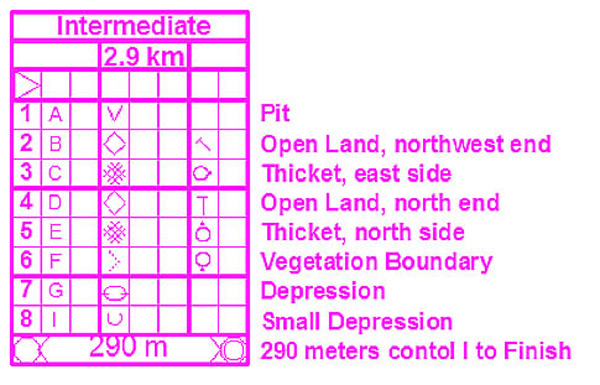
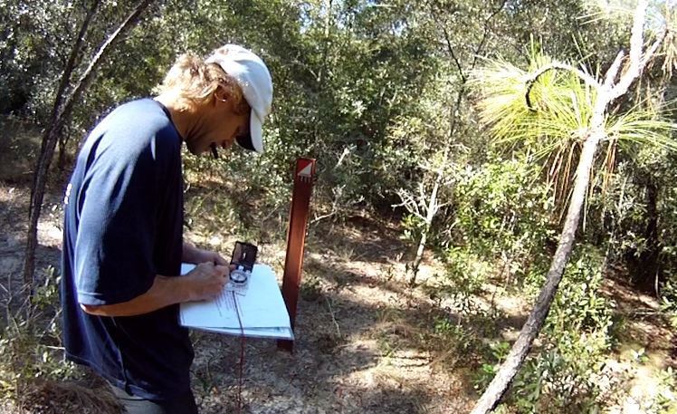
8am came and it was time to start. We chose to do the foot portion of the initial challenge first. The initial challenge was a warmup of 3 run and 3 bike points. I made a huge mistake right off the bat, thinking the direct path to CP4 was a lot further than imagined, and that our main TA ground was as small as the area that the blue square covered on the map. My thinking was that we would take the left path up and then bear right through the green woods to find CP4. I took our team to the left path, but the right path was the more direct approach. That mistake made us spend about 40min on the first control point alone!

We had 7 people scouting out a huge area. I think we almost went to the boat TA, haha. In fact, we were so disoriented, we found CP5 first! The girls were so energetic, they scouted an area 4 times the area the guys did. One of the girls finally found CP4, and we were happy to move onto CP6. At that point, I learned not to cut through forest much, and to keep on the trails as much as possible. It was challenging to keep a straight line when bushwhacking. I honestly forgot how we found CP6, but it was straightforward coming back. At the main TA, we swapped to bikes.
I knew that the bike trails would contain longer distances, and longer distances meant more length for error, so I measured out the first leg of our bike in kilometers. It was roughly 0.75km before we would make a right turn. I have a pedometer so it was easy to measure distance traveled. CP1 didn't take us long at all. Heading over to CP2, however, I got disoriented again. It was pretty challenging to bike with one arm, look at the map, while using the compass to confirm direction. We rode to the end of a pier before turning back to cross the bridge that led to CP2. The map was pretty damn small for this section, so we rode on just about all the trails in that peninsula before finding CP2. Looking back at the map, I could make out where the unmarked bridge was and how we went about finding CP2.

We then headed down to CP3 and found the bathroom. The clue was to walk 90m from a 54 degree bearing. Within our line of sight and walk on that line, we could not find it for the life of us. Everyone hunted a large area in that direction as well as around the bathroom, looking inside trashcans and up trees...nothing. I then headed down another mapped trail to confirm this was the correct and only bathroom. After 30minutes of searching, people began losing faith. We started getting food out for lunch. Then came the yell, "I found it!" Those were the greatest words ever. And those orange/white lantern bags were the greatest sights ever. Amber was in the vicinity of the CP and had found it in the very middle of the grassy/thicketed island. We then headed back to the main TA. It was no surprise to hear that we were the last team to finish the initial challenge, aka warmup, after spending over 2hrs in the wilderness. Up next were the canoes.
Canyoneros (Greg Watson, Hien Nguyen)
Swamp Donkeys (Josh Hemann, Russell Barton)
3 Blind Mice (Brian Ruth, Amber Punga, Amy Hazlerig)
Boats
Greg and I were the only ones with double-sided paddles. We learned from last year not to use single-sided paddles. Testing them out, they required much less effort to row and steer with. In the morning, I had expressed my concern that the canoe section would be the most difficult to navigate. I had Googled (satellite view) this area ahead of time and saw how many twisty channels there were, un-mapped at that. When you're on water, there really isn't much you can use in terms of distinctive features mapped in order to keep you oriented. Sure enough, it was exactly as difficult as I imagined it. My strategy was to try to stay ahead but the tiny map wouldn't allow me to see much. Channels and intersections came up quick and you had seconds to make a decision on which path. We completely turned around often. Compound that with the fact that if I stopped paddling to look at the map, it was difficult for Greg to steer the canoe. And lastly, no one practiced canoeing for this event.
Looking at the map, CP7 and CP8 were the only ones out in the distance. I strategized by going towards the cluster of CPs first. That way, we would have a better chance of seeing other people heading down the right paths. Apparently, we were too slow, so the majority of competitors had cleared the area already. The other reason was to be able to cut off the longer distances should this portion take too long.
CP9 was pretty easy to grab, as was CP10. From CP10 to 11, there was an intersection half-way between. I had Greg time the first half, and we would canoe the 2nd half based on the time measured from the first half. The 2nd half was much faster paddling, so we got there in almost half the time. I thought to myself, no way could the CP come up this quick. When we arrive to the CP, it had a different number, other than 11. So we made a huge mistake of not punching! We continued on to try to find this CP11 but could not find it. We also turned around, went past the real CP11 again and then turned around again after calling it quits on CP11 (solution explained later). We said we would try to find CP11 on the way back up, and then headed to CP12.

We beared right (our right going downwards) on the way down to CP12 the entire time and felt comfort in seeing another team making their way to CP12 as well. Unfortunately for them, one guy was stuck belly deep in the shallow water and thick mud, trying to push his canoe through. He said he was stuck and cramping. His teammate was flat in the shallow water on his belly, in what seemed like he had no control of his position. We didn't wanna duplicate that maneuver so we turned around and tried to navigate in another direction, a direction that took us to the opposite side of the stuck team! They were still stuck there! We then turned around and headed down another channel. There was an abandoned canoe, docked. We saw that as a sign that another team chose that area as an attack point to CP12. Sure enough, it was, but the team that just finished finding it gave us the clue of "it was the gnarliest CP yet". We did the same thing. We trekked into there on foot, grass chest high in some sections. I saw a large black widow spider hanging from an equally large and healthy web. On the map, the CP was right along the water, so I told myself if I traced the channel, I would have to eventually run into it. We must have trekked 15minutes into it before I found the control point. It suddenly hit me that all CPs have a different number than what's on the map! But this different number corresponds to the real CP# on the punch card! That's when we realized that we had already found the real CP11 earlier!
Team Canyonero (foreground) and 3 Blind Mice

Heading back to the boats, we pushed forward and had to carry our canoe briefly over some shallow sections. I led our 3 teams in the wrong direction again before correcting us. As we paddled towards CP13, I got better oriented with the compass and confirmed our position. Greg and I sped ahead, using the advantage of our double-sided paddles. Gradually, we couldn't hear the other teams anymore. We stopped. It was the right thing to do so that they didn't go down a different channel. I fueled up on food and water, and continued to confirm our position. Finally, we heard team 3 Blind Mice. When they caught up, Greg and I learned that Russell and Josh had capsized their canoes, lol. The girls on 3 Blind Mice said the look on Russell's face was priceless--utter frustration. At this point, the girls still seemed high spirited, singing and laughing along at our mistakes. That was cool, so long as they weren't sour by our learning experiences. CP13 and 14 was not difficult at all. We all stopped at CP14 and tried to trek across the grassy and marshy median. If successful, it was an immediate direct path west of us to regather CP11. Greg and Amy deemed the area not swimmable while trekking through the median, so we had to take our canoes all the way back up and u-turn back. It was a 15min ordeal or so of navigating over. On the way back up the channel, we made one
crucial mistake of going left towards CP10 instead of northeast up. It was another one of those intersections that gave you a few seconds to choose. It literally took us on a path that was probably 3-4 times the length of the right path--a path so twisty and narrow.
Cutting CP7 and CP8 was an easy choice considering we spent 3hrs and 30minutes on the boats already. Once on shore, we were once again told we were last :) Ah well, good times indeed! Russell came out with a severely sore knee, and that concerned me because we had not even biked or trekked the real portion yet. The canoes down this channel were the most difficult navigating experience ever...but we made it out!
Bikes
At the main TA, the team refueled, changed clothes, etc. We decided that we all had strong biking in us, but not all of us had strong enduring running, so we stuck to biking. It was a great choice. My bike started to shift gears on its own, but I managed. We headed back east down familiar territory on Princess Place Rd, towards CP 20. In the distance was Art Homs (our coworker) and his wife. We shouted out at him. I kept us oriented to the correct location at first. We ran into a privately own cabin and started to hesitate putting our search force into use, so we headed back out and followed the water (CP20 was located on the water). We eventually found CP7, a boat CP, but it wasn't the one we were looking for. I looked over the map again and noticed an extremely small dot on the map, a symbol for a man-made object...the cabin! Determined, I knew the original spot I led us to was close. It should be immediately west of the cabin. I swiftly headed over there again, using the same tactic of using the edge of the water as a handrail. I found it! It was hidden behind a tree, in which you would barely be able to see it if you were headed towards it.
CP21 on paper was vague. There wasn't really any attack points visible on the map. I decided to measure the distance on map (0.66 km) and use the pedometer. We headed down 'Unnamed Street', past the bathrooms which fired up despise in us, past Gate1, saw a deer gracefully cut across our trails, and past Gate 2, which is where I reset my pedometer. The bike trail was extraordinarily nice! 0.72km later, we stopped and hunted. There was a small stream of water to the left of us. Mosquitoes started swarming out and it was where I got my first few bites. Amy, Brian, Greg, and I think Amber, headed further down to cut into the woods. I went in at .72km, and Josh backtracked to 0.66km. My original measurement was dead-on! Josh found the CP. Everyone punched their cards and we bolted to the next CP.
We had about an hour and a half left at this point. I decided we had enough time to run over to CP23. Again, amazing bike trails, combined with the smooth road of I-95, where we hit speeds of 25mph, as clocked on my pedometer. Knowing that measurements on bikes were proving successful, I visually deemed the section between I-95 and the entrance into the trails that led to CP23, 0.4km. I'm sure that was the only trail around there, but I felt much more comfortable confirming this distance on pedometer. Sure enough, 0.4km after I-95, there was an opening into the woods. There was a sense of urgency that allowed us to quickly get there hop off the bike to hunt. We entered on the left side of the trail, and I used the compass to follow the top of the loop until it started turn southeast. This is where I sent the search party out. "Under a billboard" was the clue. We covered large grounds and couldn't find this CP. I suggested to the others that the clue could also be a riddle. For instance, billboard might be a tree with a huge canopy. Or the word 'under' could mean south of a billboard we saw on I-95. Neither was true, as we met another team who found it before us. I'm still not sure the CP on the map was accurate to the location in real life. That was a strange location for a billboard on the side of an interstate.
We stormed out of there and headed back. We had plenty of time to left, and since CP24 was on the way back, we decided to find it. We had no trouble finding this one at all. My orienteering was becoming sharper and sharper as the day went on. I was able to keep myself fully oriented on the map, turn for turn, at all times during the biking portion after CP20. We took rode up Princess Place Rd and turned into the trail that was east of CP24. Amazingly, it was the only section where we ran into the dreaded sugar sand. A few minutes of trekking through shrubbery and woods, and Brian spotted it. Apparently, Russell had fully seized legs on this stretch of road to CP24, and took the path of the bridge up to find it.
Trek
With still a good amount of time left, we headed back to the main TA, where we had 30minutes left. Russell and Josh lagged behind and checked in to finish in time. Team Canyonero and 3 Blind Mice pushed north, with even more urgency to grab one trekking control point--the closest one, CP15. We were running, and I was calling out what turns to expect ahead with pinpoint accuracy. From the main TA to CP15, we only spent 6-7minutes! Once at that intersection, Amber immediately found it, except she had lost her punch card while running over! Greg suggested she punch her map and head back, which she did. Team 3 Blind Mice then re-traced their trails to find their punch card, while the Canyoneros took the direct path back to camp. My thighs started getting painfully cramped on this last leg. They seized completely up, right in front of the finishing table, where I was down on my knees stretching them out for a good 5minutes before being able to get back up. I looked up and saw 3 Blind Mice locating their lost punch card at the opening of the forest. Good for them, we all finished within time! We're hooked on this sport.
Race Details and Results
http://www.pangeaadventureracing.com/event-details/events/2011-lighterknot-ar
Race Photos
http://www.facebook.com/media/set/?set=a.10150334908096375.342378.108723771374&type=3
http://www.facebook.com/media/set/?set=a.10150336027351375.342567.108723771374&type=1
Pangea Adventure Racing Facebook
http://www.facebook.com/pangeaadventureracing