Canyoneros set out with six strong and ended with everything that could have happened in a AR race. Things are still unpredictable for us at times, but that's what creates memorable stories.
Bike
The race started with the bike portion for our two teams. We led the pack down the dirt road into CP19, doing it in a counter-clockwise fashion, where flashbacks of the Nocturnal race came to me. This time, there was no hesitation, as the trail was still flooded, but we trucked in like madmen. Off in our peripheral vision, a gator darted away. The pack behind us dropped their jaws, gazing down this river of a path, but gained confidence as we showed them the way.
Greg heads over to punch CP19
a race where Sport and Elite teams run together
CP16 was easy to hit, as was 15. On our way to CP17, one of our original Canyoneros, Russell, underestimated the size of a log and with his new 'Chuck Lennon' skills and Specialized 29er, decided to try to fly over the log at good speed. It didn't work :) but with the stubbornness we are characterized with, he got up and shouted "YOU DIDN'T GET THAT ON GOPRO?!" We knew he was in a world of hurt and it slowed him down throughout the race.
one shout is all that's needed for everyone to attack CP15
CP14 and 13 was a matter of going the measured distance and constantly checking the bearing of the route. We headed back to the Main TA, second, only behind Ron Eaglin's powerhouse team.
Trek
CP1 was a no brainer along the trail. We got to CP2 after getting veered off course a bit on the trail bend there. We lost track of the trail markers on the trees, but quickly backtracked to the known creek to find our position again. Having 6 sets of eyes made things very easy.
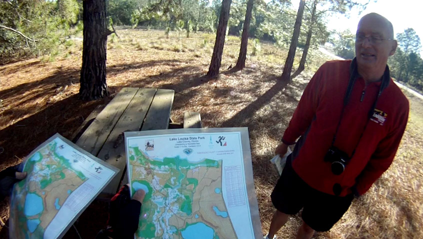
race map
CP4 was the first to slow us down noticeably. We ran a pre-measured distance of 550m from the trail after CP3 to CP4. However, we all miscounted our paces, so I started looking for a clearing on our left, instead, as mapped on the National Geographic map. Once we saw Ron poking out of the woods north of us, at that exact area, we knew we couldn't be far. Again, our six set of eyes found this one.
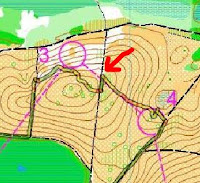
After that, I made a mistake of completely overlooking CP5, so we attempted to head to CP6. From CP4, I headed north, hitting the yellow trail, while trying to find a distinct sharp bend in the road (marked A on the map below) that we were to use as an attack point to CP6. The trails aren't really trails out there, more like ambiguous gaps between trees, so it was tough to determine if you were going around a particular curve or not. We identified this 'apex' prematurely and headed up the wrong area, where Juan found CP7, instead. Thinking CP7 was 6, we shot a bearing along the vegetation border and counted paces to a non-existent CP7, in an L shape. After spending about 15 minutes searching, we went south to the yellow trail to find a different attack point. Ron trucked by us, again, seeing confused faces, helped us out by pointing out exactly where we were, which we were able to use to find CP8, back to 7, and then 6. Thanks Ron!
green is the route that we took. yes, it is very dirty
Our misfortunes in navigating did not end there. We headed to CP6 using the northern vegetation boundary, but thinking we were on the lower one. The two had the same bearing. After about 10 minutes searching in the wrong corner, Nate became suspicious of this mistake. He confirmed with me and we found the oak tree we needed immediately. Nate is my navigator in training and has been correcting me very often. We have seen his skills grow in the Florida Orienteering events, and I think he's our next navigator :)
re-grouping to figure out where we are
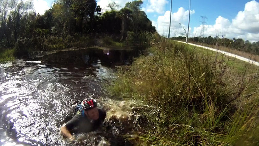
On the way out, we debated the idea of traveling on the yellow trail to head back before going north on the red trail (blue line below). Distance-wise, it made better sense to bushwhack north from CP6 to hit the main dirt road (green line below). We had a couple attempts at bushwhacking north before blazing a trail out. This bushwhack was a dense, engtangled wall of thorns! Those of us who did not wear long pants learned a lesson, haha.
which route is quicker?
pushing through walls of brush and thorns
Adding insult to injury, we were met with a swamp at the end of the bushwhack, which turned into a sewage ditch on the side of a road. The look on their faces was priceless!
Greg Watson, Brian Ruth, Juan Chavez, Nate Whitaker (left to right)
Russell Barton
I got this idea from Ron (in fact, I get all my ideas from Ron)--using a phone GPS tracking app in my backpack to record our route. Don't worry, we don't cheat, otherwise, we wouldn't have gotten so damn lost. It's very useful to review the strategies and decisions made at the time, and it's also very funny to see you going in circles when lost!
Canoe
The ride to the Boat TA was 4.5km, hard-packed, which is heaven compared to the trails at last month's Turkey Burn. However, Barton only had power to one leg. I've seen him at the gym. One leg still provides 500ft/lbs of torque!
three canoes setting sail, one was the speedy silver one
We managed to get to the Boat TA with both punch cards missing! Up til now the strategy of having one guy carry two teams' worth of punch cards worked. Ah well, we're out having fun with a large Canyonero army. If that happens to anyone else, use your instructions or map to punch with. We still got deducted a point for losing a punch, but at least we still got credited for clearing the canoe portion.
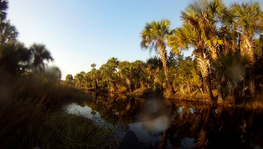
looks much different during the day (vs the Nocturnal AR)
let no man be left behind
This race probably had enough events to fill a 30hr race, yet it was only 3.5hrs long. To recap:
- Barton completely flipped over a log, head over heels, landed his thigh on it, and grew a lump the size of a grapefruit.
- We got lost badly on a couple CPs.
- We completely overlooked one trek CP :(
- We trekked through chest deep sewage and thorns.
- Both of Brian's legs completely seized on our ride back from the boat TA and got tossed almost into a ditch. The demonic lumps on his legs were so excruciating, it turned his face blue.
- We lost both of our canoe punch cards - one penalty per team.
- We came in late - another penalty per team.
- Our navigation was flawless on bike and canoe, not so much on trek.
All in all, Canyoneros still get up fuming, but continue on forward, telling tall tales of glory :D