Brian flew down from Boston to join us for a fun get-together. We had all taken a break from training during the holidays and did a quick one week cram session to ramp back up.
Greg reminded Brian to do the first prologue jog at a fairly slower pace. Regardless, his excitement took him towards the front of the pack. We blazed through the first three legs, a quick run, a short bike ride, and a small orienteering section. Nate and Brian were full of energy and pushed the pace fast.
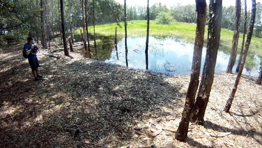
Everything was going quick and well until the infamous CP7 on canoe. What seemed like it should have been another easy pick-up turned into a stubborn 55min hunt for a control that was later determined to be lost. Every team converged here and we had the most elite eyes on this hunt.
our sweeping search pattern for CP7
After this control, we knew the race had been botched. We continued forward to collect the rest of the controls on paddle, only to be met with racers making their return trip, telling us there was no CP9 either. At this point, we said screw it, let's just go there, cover our basis, and if anything, we have it on GoPro that we at least visited the area and to make a case for credit. We spent about 10min searching for it at the location to no avail either. Turns out all teams got credited CP7 and 9 (and later on 11), regardless if they went after it or not. Ah well. With the main pack well ahead of us, the race mentality switched to just having a good time after this point.
Nate convincingly saw CP7 with his x-ray vision in another stretch of the river, and adamantly had us pull over to hunt briefly. I knew it wasn't there, so I took my time taking a dump in the woods.
race maps
We approached the Iron TA on canoe and transitioned into a six-control orienteering course. One of the controls, CP11, was situated in the same spot at the missing CP7. We decided to give it a 5min try, this time attacking it from the east, to see if we see anything new. Nope, my navigation led us to the exact same spot. From there on, we made good time with finding the rest of the controls.
Getting back on the boat, we paddled back to the Main TA. I erroneously thought we had a mindless jog from the Main TA to the Withlacoochee TA, where we dropped our bikes off early in the race. I did not realize we had three controls to pick up en-route. What a mistake haha.
With a quick transition back onto bikes, we nailed every control with relative ease, except CP25. To me, navigating on twisty technical mtn biking trails are the toughest to understand where you are on the map. You can never measure distances correctly on the map because the resolution does not account for all the curves, peaks, and valleys that add up. We attacked this control in two locations before finding it.
We can always count on Brian locking up legs early on in the race ;)
Once outside the mtn biking trails, we knew time was of the essence, so we turned on the afterburners. The crew did an awesome job spotting controls whenever I mentioned we were nearby. We had only enough time to gather two controls on the last orienteering leg. We grabbed CP29 and 30, where my legs were on fire with cramps. I had no choice but to shake it off and fly back to the Main TA, and topping at 37kph on flat paved road. However, we still came in a minute and a couple seconds late.
Team Canyoneros - EA Sports (Greg Watson (left), Nathan Whitaker, Hien Nguyen, Brian Ruth)
Team Canyoneros - EA Sports - Greg Watson (left), Nathan Whitaker, Hien Nguyen
The tires of our front wheel drive Ford Explorer were spinning along a windy wet and paved road that took us uphill into the lodge in Pine Mountain State for about 4 miles. We joked and asked, "what if we end up having to bike up this quad-ripping route?" We were one of a handful Florida teams who qualified for the championships, but nothing prepared us for the terrain ahead, except Kelly's awesome spin classes at the RDV. Sure enough, this seemingly unending ascension into higher altitude was just a tiny fraction of the race, thrown in at near the beginning of the race.
pre-race meeting
The night before the race, there was a serious meeting in the conference room of the lodge we stayed at. We looked around and understood that these were many of the best adventure racers in the US. It was great to see some of the teams we had tracked and rooted for at other big races throughout the years.
We woke up early the next morning, had breakfast and spent 1½hrs plotting CPs on the two maps we received. We had two Canyoneros - EA Sports teams confirming points off of each other to ensure accuracy. This was the first race we had plotted a substantial amount of controls for, and we needed the entire time to do so. There was no time to mark a route or strategize a plan. We did all of that on the fly during the race. This scenario was a first for us, but we enjoy figuring out new challenges.
We then loaded up on buses and were dropped off at a bridge looking towards our first set of mountains. The race director gave us a map and we quickly developed a plan to gather two controls to equal the required ten points, CP 4b and 6. Starting in the back of the pack in no hurry, we naively followed the mass towards CP6 into an erroneous trail that lead us uphill. I thought surely that many national-level racers cannot make that badly of a mistake in a prologue, so I had turned my navigation thinking off. That bit us as, we burned about 25 minutes looking for CP6 in the wrong spot. We spotted a river and a house that I did some reverse bearings against to realize we were nowhere near the right spot. The only way to correct that was to backtrack out to the trail head, and once we did that, I knew exactly where we were.
As we made our way back to the location of the bridge where we had previously dropped off a bag of paddles I counted 9 bags left from other teams. There were 58 teams competing this day, so we started off in 49th place. That was frustrating to me, but it was great to have teammates who are always encouraging ourselves out of the lows.
Once we jogged to the boat take-out with our paddling bag, you had to carry your canoe about 50 meters to the river. Being near the end of the pack now, we had last choice in canoes, and the ones left had broken handles, which made things more difficult. The route was rocky, slippery and even had a section where you trekked uphill on a slippery slope. Team We Will Survive, with two ladies and an older gentleman, appeared to have trouble carrying their canoe over the obstacles and up the hill. Greg graciously helped them up, carrying canoes in each hand.
The paddle was pretty short and easy, but for some reason, we could never get our steering as straight as we liked. We felt better as other teams reported the same.
After the paddle, we jogged over to pick up our bikes in another location, an outdoors amphitheater that had seats made out of boulders. Here, we set off on our first brutal uphill climb that we had joked about. This section was deemed "king of the mountain" and was a timed section to see which team was the fastest. We obviously had no intentions of winning this :)
The next section was a trekking section that took us deep into the bowl of a mountain region. I relied a lot on Nate's experimental pace counting strategy. He had figured out some method of pace counting that takes into consideration the angle of elevation and wanted to use this event to fully calibrate his algorithms. It was quite genius and highly accurate, in fact.
To get some of the non-racers up to speed, one foot step while jogging is roughly 1 meter. So when I measure 100 meters of distance on the map, it's a "as the crow flies" distance. We can jog 100 steps on flat ground and it will roughly be 100m in real life. However, it does not take into account elevational changes. When you traverse up and down hills and mountains, it may take 150-180 steps to reach a measured 100m from the map. It's highly variable. Nate had this all figured out in his head; it was genius! This especially helped on CP7, where you could have easily and painfully gone up the wrong re-entrant since there were two side by side ones.
As we wrapped up this orienteering leg, we ran into team We Will Survive many times, who seemed to effortlessly traverse up and down the mountains. They were always able to more intelligently spot the easier way around an obstacle; we just thick-headedly endured through the steep areas. It was amazing to see and we hope by the time we reach their age, we could still be at their fitness level.
The next leg was the forewarned long biking section. I think we spent over 11hrs on this route, starting with CP9. Coming down the mountain of the previous trekking leg, we had run out of water and needed to refill somewhere. One option was going back to the lodge, but that kinda threw the line choice off. I busted out the map with the rain pouring down hard and tried to see through the debris that had smeared across the map. I frantically found a route that cut back to the amphitheatre we came from earlier, which would give us access to a bathroom with water. It was a primarily downhill path, the opposite of what we suffered through earlier. Also, worthy to note is that much of my on-the-fly navigational route choices came from the first route that I could connect. I had to quickly locate and commit. Luckily, upon review, they were the best routes we could have chosen.
The biking was a pure slog. This section basically summed up the entire race. It was rainy. It was cold. There were lots of pushing the bike uphill. There was mud, mud, and piles of mud! Even the stretches of downhill weren't a pleasant coast. It was a death-gripped, drifting wild ride. Somehow Nate's performance increases exponentially in the cold and wet. At one point, Nate fell into a ditch full of muddy water up to his neck :D Night racing always has this eerie awesomeness to it when you're out in the middle of nowhere.
Surprisingly, we didn't run out of water during this 11hrs. If the temperature was warmer, that would have been much different, and there's no way we would have sourced any water from the ground around this area. The race director warned us that there were mine fields all around, which probably had chemicals leaking everywhere.
Night fall passed and we finally made it to the canoe section. Here, there was real food sold in the building of a water treatment plant. They even had the heater turned on in the warehouse! It felt nice and warm in there. The canoe section was very short in a small lake, not that I'm complaining. It contained the best bang for the buck CPs.
canoe map
Around 2am, we finished the canoe section and got back on bikes to find two more controls. The combination of the night, rain, and windy biking made this time the coldest part of the race. Looking at the map, we knew we were in for a mountainous trek, not a bike ride. We spent around 2½hrs pushing our bikes uphill to gather these two controls. It was excruciating. I promised the team that there was a glorious downhill coast after gathering CP21. Cold, shivering, and miserable, the team held onto these hopes as we punched CP21--it was like the golden light at the end of the tunnel. But as we parted the grassy trail leading downhill, what we saw was a steep, rocky, and incredibly slippery slope the entire way down. "Can't ride this shit down in the rainy night" Greg confirmed. Damn, he was right. Clip one rock wrong and you'll roll down like a rag doll. Needless to say, we spent the next hour or so, carefully tip toe'ing down the entire path. What a letdown. I developed "lazy quads" by the end of the 95km biking section. It taxed my quads so much, that by the end of it, my quads didn't want to have the energy to stabilize itself walking anymore.
The last orienteering section was apparently a 15 mile trek. We started off gathering CP30 to the north of the lodge, and went west into a counter-clockwise direction, leaving CP28 and 29 as outliers, just in case we had time. We were told CP23 had been super tough to lots of teams but by the time we reached it, the morning had lit up the day for us to better see in the woods--woods that didn't have any bugs or spiders! We always eat hundreds of bugs and spiders in FL as part of our nutrition ;). We nailed CP23 on first try and then proceeded to bushwhack directly to CP24.
final trek route we took as I recalled it
None of us had functioning altimeters, and I knew a sharp bearing across a near 1km distance was going to be impossible for us to nail accurately in the mountains. I had us following the re-entrant all the way down until we hit the road. It was the most epic 55min bushwhack to date (some of it was captured on video earlier in the blog). At that point, we ran back to a known intersection to take a straight bearing to CP24. CP25 was also attacked from the same intersection of road and trail. We climbed very steeply but accurately. After gathering CP26 and 27, we calculated getting the far eastern controls would potentially put us in a risky time situation and called it off. In a rogaine-formatted race, you would lose one control for every minute you were late. That's harsh. We didn't want to be near that red zone.
In the end, we finished 4th in the Open-Division and surprisingly won the Honorary Spirit Award after being nominated by team We Will Survive (Thanks guys!). This award was for displaying traits of an admirable adventure racer, helping and encouraging teams out there. Often times, it is a win just to be able to last 30hrs, let alone race it competitively. And in this year's championship course, we agreed it was the most brutal terrain combined with weather condition we have experienced. It broke a bike spoke and flattened a tire along the way. Kentucky's a beautiful area and I'm sure it would have been even more of a spectacular view on a sunny day.
Like our fellow Florida team, Team Disoriented, we are amazed by the fitness levels of the national caliber teams. We're proud of the top US winners, like team Tecnu Adventure Racing who cleared the entire course in 16hrs 22min, and look forward to seeing them compete at the world ARs and championships.
This was a race that was billed to be the most brutal Florida-heated adventure race ever. It was in the summer of July and was 36hrs long. Of all people, Nate was the one who convinced Greg Watson and I to race this one! This was his race of redemption, he said, for severely overheating in a 6hr race two years ago, at Pangea's Treasure Coast AR in Hobe Sound, FL. He wanted to face his demons and take us on a ride with him, and do this in a grand 36hr fashion (yes, that is 6 times the length of the one he got broiled alive on).
giant maps, accompanied with dozens of supplemental ones
Erik Wise and Mark Schweder, the race director and course designers, gave us a unique experience. There would be only three legs of race. Once you're done and checked in with one leg, you move onto the next, but you could not revisit a previous leg to find more controls. This meant you'll be on bike, foot, and boat, for a very long period of time. We underestimated how much water we needed to carry at times but the water jugs that were brilliantly scattered about were saviors. There were probably enough control points to fill a 72hr race, so we picked and chose whichever controls we thought we could easily find.
Biking
Most teams started on trek, except three, including us. We let Nate choose bike first, since he's most prone to overheating on bike. The race started a little after midnight, a night buzzing with insects and drizzling with rain for an hour or so while we scrambled to plot controls and strategize maps.
In the middle of the night, we were going up a narrow path between two fences. The path was littered with trash and overgrown with vegetation. The clue was "rubbish pit" so we had a hunch we were in the right location. Far in the distance, I spotted a dozen glowing eyes that seemed to be headed our way. "Dogs! Turn around and run!" I silently screamed. You don't know what kind of dogs people out there own. The trash and entangled plants didn't help us move very fast. Next thing we saw were giant horses to the our right. It spooked us a bit, but once we realized they were harmless horses who were curious to see us, we were relieved!
Further along after sunrise, we had just found CP44, about an hour away from civilization. Nate and I completely ran out of water. I noticed that on the map, there was a water cache deeper in the wilderness about 30 minutes away. At that point, we made the decision to go forward and find the water cache, instead of the backtracking an hour to the known city. The off-road trails varied from bumpy hard-packed to muddy sand and grassy terrain. It wasn't smooth. It continued to eat away at our dehydration.
Nate was spiraling into heat exhaustion (red cheeks, profuse sweating, and rapid heart beat). His temps read 102F at the wrist. We took little rests here and there under the shade while I worked the map. Eventually we got to the location of the water cache, but I missed it on first try. There were no water jugs! Did someone steal them?! What if a previously visiting team drank it all?? The worst-scenario thoughts kept our blood flowing. I backtracked, recalculated distances with my pedometer and found another trail to go down. Bingo, found it! It was amazing. We refueled and re-energized here.
There were a handful of controls where there were missing trail illustrations on the map. I never used the 50 or so supplemental bike maps provided due to the inconvenience of map fumbling, but we made some great guesses at which trails we should go down to find the controls. Greg had some incredible vision to spot many of these from far away, and some great trail memory to get us out.
The heat continued to beat down on us. It was like breathing fire from an open oven. The pace slowed considerably during the day to keep the heart rate manageable. We were sweating more than we drank water. We had to ration what water we had.
It took us 15hrs to finish the biking section, across a distance of 147km (91 miles). And we didn't even find all of the controls. This would be the longest any of us have biked continuously, on a time-basis.
Trekking
This far into the race, it was tough to jog. We walked about 90% of this leg. Doing so allowed me to be pretty accurate with navigating. I actually used a few of the supplemental maps provided. We nailed most of the controls predictably and steadily. The weather blessed us with a drizzling overcast rainy condition for when we started this leg in the afternoon. Along our trek, we caked our shoes with mud which made things a bit uncomfortable. Greg made some great calls on washing the mud out of our socks and shoes at a well pump that we found.
There was one control that got the best of me, which was the mandatory CP11. We found CP10 easily, and my plan for getting 11 was to follow the river channel back northeast, cut across to the other side near the bridge, and then follow it right back down.
We found the "pole bridge" but there was no punch to be found. Confused, I took the team to three other attack points in the trail system to re-confirm our position and every single time, we found the same pole bridge again. We even bushwhacked straight between trails, through dense and thorny forestry, from known intersections to try to find this. Now it was totally dark and we had burnt 2hrs on this control alone. Finally, Nate commanded I re-read the clue for CP11, which was "write down the numbers located on the pole bridge"! This was a control where you had to write an answer down, not punch the card...ughhh! I felt for the Ecuadorian team who spent 4hrs trying to find it while we were there too.
Deep in the night, while trekking through the northern end of Newnan's Lake, there were strange animals in the woods that appeared to quack at you in a bizarre human voice. We saw hidden deer cameras behind tree foliage and iridescent plants. There were plenty of armadillos running along our path. The night had a awe-inspiring mystique to it. One of the controls was even in a cemetery for a ghostly setting.
Worthy to note too is that this is the most I have ever prepared to combat bug bites. I sprayed my clothing down with Permethrin, used bug patches, and wore long pants the entire race, a highly effective measure in the past. I still came out of the race with 40-50 bug bites! Newnan's Lake has some of the most terrifying and persistent bugs around. We even had a giant three inch momma spider come into our canopy tent and release 200 baby spiders before the race started.
After finding several controls north of Newnan's Lake, we started our journey back to the main TA. Heading into the main transition area after about 14hrs of trekking, the team was wretched with feet blisters and ass chafing issues. We had been trekking for some 45km (basically a 27 mile marathon) nonstop through the night. It was mainly off-road with mud and sand to grind away the flesh. We spent an hour at transition to refuel and to clean up.
Canoeing
We had six hours left once we launched the canoe into the lake. Nate did an awesome job plotting UTM coordinates for this section. The number one goal for us was find the mandatory CP9. Rules were, you had to find one mandatory control per discipline in order to be officially ranked. With that in mind, we started our canoeing route by going south into the lower channel on Newnan's lake. Along the way, we picked up 4 controls. It got too gnarly with fallen trees and debris enroute to CP8-9, so we ditched the canoe and walked along the bank for both of them. I had wanted us to get CP10-11 further down the channel, but with how hairy things got after CP8, we bailed out of the channel and went north to get two more controls. In hindsight we should have banked more time on the canoe, as they provided the best bang for our buck. Each CP was worth 3 points.
In the end, we got 1st in our division, 2nd overall. Nate survived the incredible heat and lived to redeem himself. We weren't banking on high expectations, but as we've seen, historically, as long as we're steady in the race, we seem to do pretty well.