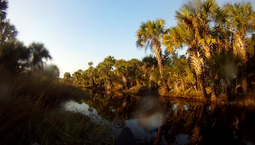
The Superhero AR was held in our backyard. We have used the parks here as our training grounds for over a year. With that said, Nate and I set out to try to defend our our home court :) We trained and prepped as much as we could. We wanted to use this race as a benchmark to see how we stand with the super elites who usually populate the top. We raced our hearts out, literally, til the end.
race instructions
Prologue
I was so pumped at the beginning of the race, I immediately launched my bike with some atmospheric torque that caused my rear wheel to pop off and flip me over my handlebars. Here's a video recap:
video of me flipping over bike at beginning
very familiar map
The start had you biking to Kelly Park's orienteering grounds, find three CPs on bike, return to the gate opening, and then find three more CPs on foot. This order was determined at the beginning of the race, so as to not clog everyone up at each checkpoint.
So after flipping over my bike, I spent about a minute and a half fixing it. When all was done, everyone was already almost a mile ahead of us. But I like to give people head starts ;) We knew this park like the back of our hand and made up some serious grounds to get back near the front of the pack at the orienteering section.
The foot section was aided by the help of several teams going for the same CPs, so it was basically a game of follow the leader.
Canoe
video of bushwhacking through canoe channels
We bolted back to the Main TA and had a 2-3 minute transition into the canoe. Our map was chock full of useful information--distances, estimated times, clues, etc. We took the north route first to warm up before hitting the more technical, upstream routes, south of Kings Landing launch.
canoeing map
The north side CPs were pretty easy to find. Most were directly visible as you paddled along, with the exception of CP8. That one was hidden behind a large mass of shrubbery, made of twigs, that was around the back side of an island.
Canyoneros brute force over these obstacles. There are no such things as obstacles to us ;)
There were several areas where trees fell across the river. It was quite convenient :) We saw a team just turn around after seeing this one and said "screw it".
CP7 with missing punch
The far east CP7 had no punch card to it, so I have it on GoPro to prove it :) Team Sheriff's Posse also found this before us, in case there's disputes (all on GoPro).
spiders fall down from these, duck your heads!
The south side split into two channels, each side containing one CP, each side with its poison. The side we chose had a highly technical, narrow route, the east channel. The more narrow the channel, the stronger the current. You had to flex some muscles to keep speed, while steering the canoe straight. If you didn't, you rammed the sides as the current tried to turn the bulky vessel around. To top it off, there were big tree stumps underneath the water. They caught you off guard at times, instantly manhandling the canoe sideways to capsize you.
You are looking at the scant amount of water available for canoeing through the south side.
We did not take chances on CP12, so we poked in and out of any area we thought looked like an intersecting channel as Greg Owens explained in the race meeting. It slowed us down some, as the friendly Team BikeWorks overtook us, but we finally found it in the middle of the water.
which channel was faster? (yellow = BikeWorks, red = Canyoneros)
Up til the last CP14, Team BikeWorks and we were right near each other. We split at this last CP. BikeWorks decided to push their canoes north through thick vegetation. Nate and I ditched our canoes near the intersection south of it and bushwhacked to grab CP14, only to return back to the intersection and go north on the east channel. It was downstream and could be traveled at a much higher speed.
To compare, team BikeWorks finished the prologue one minute behind us, so we assume they got on boats one minute after we did. However, they cleared the canoe course three minutes ahead of us, indicating that west side was the faster route. Maybe the their route opened up? Who knows, but most people said that west channel got hairy. Another top ranking team did what we did as well--got back on the east channel.
Bike
Nate the Great slicing through the single-track trails
bike and running map
We measured out every distance here and a couple angle of attacks per CP, just to be safe. On the way to Wekiva Springs State Park, we picked up CP15 by spotting the fence from the trail and following it to the southeast corner. We then checked in at the Wekiva TA, a gate, and retrieved CPs from 16->17->18->19->20->21->22->23.
carving our own trails in the woods
With pedometer and accurate premeasurements drawn on map, most CPs were nailed spot on, except CP17. I accidently read my notes wrong so we over shot it at first. Regardless, this section only took us 61min, as reviewed on GoPro.
trails made of pine needles
dreaded sugar sand trails...and our coworker Art Homs posing from team Swamp Gators
trails in the trenches
Run
There were two teams we kept seeing on this portion of the race--Florida Xtreme Hunter and Get to the Chopper. FL Xtreme Hunter had an 11yr old kid who kept up so well with us for most of the running CPs, even though we took different routes at times. This motivated us to take the riskier bushwhack routes we later chose. Get to the Chopper were ahead of us to start, until CP26. We chose the direct diagonal route from the trail intersection, but I think they went south and cut in east at 90 degree. I'm not 100% sure, but this is where we gained ground on them. However, those guys are fast and wouldn't go away that easily.
this is probably the closest you'll get to a mountain in Florida :)
these ashy twigs were charcoal sticks to your clothing
bolting back to the Wekiva TA as we finished with a strong lead over the previously nearby teams
Bike back to Main TA
It wasn't over until you got back to the Main TA. We knew Get to the Chopper were behind us, and we knew they are one of the more reputable teams. Heading home, I made a mistake of overshooting the Kelly Park fence trail by going past the yellow tape (because that's where we came from after gathering CP15 earlier in the day). The race was getting later and the mind was wanting to shut off. Once I realized it, we immediately took a right to cut into the woods and bushwhacked the bikes diagonally up to the trails. This was our most exciting story of the race.
That was the time needed for Get to the Chopper to catch up. We saw them! It was like the Boogie Man coming out of the corners, grabbing your legs as you ran away. Nate is a stronger runner than I am, but I knew we needed every ounce of energy from Nate's biking to pull through for the final few minutes.
start of the chase
I had the punch card and led our team back. I knew I could pull acceleration anytime since that's my strongest discipline, but wanted to honorably adhere to the 100 meter rule (team members cannot be further than 100 meters at most). I constantly looked back to make sure Nate didn't fall past this. And then they overtook him. Dammit...my fault for making that final mistake.
No...
...only a couple minutes left til it's over...there's no giving up, ever...
Nate summoned the fumes left in his tank. Get to the Chopper and Nate traded places a few times. Each guy was probably thinking, "stop coming back!" Each guy, trying to force one ounce of gas go 40mpg at 100mph. It was incredible, but nerve-racking to watch from ahead as I glanced back many times.
By the time we got sooo close to the end, I looked back, and a tiger unleashed out of Nate. He gained a few feet of advantage over their last guy. I screamed "YES!" in my mind--that was all that was needed! Both teams stormed up to the front of the finish line tent, both teams ONE SECOND apart. Canyoneros were on the fortunate end of that second!
the gates leading to the finish line
As the story was recapped later, Nate told me his heart almost exploded out of his chest--he had never biked so hard in his life. I heard there was some Nascar jockeying for position. We honestly really didn't mean any harm.
Imagine 9 o'clock pm...it is completely dark outside at the park...you look into a forest, where you think and know there should be a trail, according to map. But you see vast swamp. Your flashlight cannot see far enough to show you where the swamp ends. You double check your bike pedometer and compass, and it shows this has to be the direction to go into. You don't know how deep it is, you don't know what animals lurk inside. But the race urgency forces you to take your chances and a step into knee deep marsh, commit, and try not to let thoughts of gators and snakes keep you from moving on. This is what started our bike section! These swampy/muddy conditions are what it was like for a large portion of the race :)
race start
This race, which would start at 6pm, was touted as "one of the hardest challenges of the year." Night + 12hrs of racing + challenging course + me battling a bronchitis-like cold = odds do not get any more stacked than this.
race map
Instructions stated that you could do the first 9hrs in any order you wanted, and then come back to the Main TA to do the sport race's bike and foot section. This gave room for lots of strategy. Since Canyoneros had lots to improve in the night, Greg and I set a few rules for this race:
slow, steady, and conservative, with a focus on accuracy
hit the paddling portion first, while there's light
maximize our stronger discipline, which is the bike
race instructions
Canoeing
We wanted to start with the canoeing because the last nightly Luminescence AR race gave us a reality check with night paddling--we got lost so easily.
The Boat TA
It was a 4.6km ride to the Boat TA. There, we set our canoes off in the water and effortlessly paddled to CP 18, 19, 20, and 24. Right off the bat, we determined our pace of what it would take to paddle a km at a speed we think we would maintain to keep consistency. We were averaging about 8-10minutes per km, even at 50% of our max ability. The water was completely calm allowing for good speed and the light breeze was cool to the body. We kept slow and accurate, making sure to keep track of estimated time and distance at every leg. It was very effective and it still turned out pretty fast.
CP25 got a little more complicated with navigation, but we finally managed to find it and head back. The rain in prior days had been raising the water in the river, submerging islands that were visible on the map, throwing us off a little. It caused us to miss CP 22 on the way out, but Greg amazingly called it and found it on the way back. In fact, Greg accurately called a number of them from far in the distance. We left CP16 and 17 to finish the canoeing portion because they looked really easy and there was a chance we would hit it in the dark. The staff at the Boat TA informed us we were the first team back.
Biking
Our planned strategy was to canoe first, head back to Main TA to do the bike loop in a counter clock-wise fashion, while visiting the two trekking portions along the way. I think we were the only team to do it in this direction. I planned it this way because it put the foot section (near the Boat TA) last. On paper, those were the hardest CPs to find, providing very little attack points during your long bushwhacks into the forest/marsh, in the dark--an easy opportunity to cut if time was not available. I also planned it this way so that we could refuel our water before racing 7hrs straight. I drink like no other on these races.
Team Swamp Gators - we see them at work :)
So on the way back from the Boat TA, we were riding at a nice cruising speed when I realized sand kept kicking up on my face. I was behind Greg, so I moved to the left of him as to not receive dirt kickback, but I still felt particles thrown at my face. Then I stood up over my map board that I have attached to my handlebars in an attempt to block my own tire's kickback from underneath--it didn't help. Where was this dirt coming from? I turned on my headlamp and I saw flies and insects bombarding my face! There was a dense cloud of them the entire way back!
Greg inhaled several of these critters so we had to go slower than we would have liked to keep the breathing slower. I rode with one hand over my mouth and nose, while my eyes instinctively shut at the last possible moment when a critter would sandblast them. When we arrived at the Main TA, I blew my nose in some Kleenex and there must have been at least a dozen. After fueling up and gathering all of our equipment for the rest of the trip, we rode a couple kilometers to the first intersection that would lead us into the woods.
(...continuing from the first paragraph of this blog) By now, it's completely dark outside and we were staring down an opening in the forest completely filled with water. We spent a couple minutes debating whether or not to find another route into the woods. Greg did not feel comfortable trekking in, so he pulled his dagger out. I had a feeling this was just the beginning. I told myself if it got waist deep, I'll get back out, but for now, let's chance it...and inward we went!
CP27 was our first bike control point
It got thigh high for my short legs. Every now and then, our flashlight lit up two bright dots in the water. Were they eyes? We'll never know. We marched forward with the bikes about 100 meters in, where I shined my flashlight deep in the forest again. Alas, there was a clear opening down the direction we were headed. Path fully confirmed!
On map, most all of the bike points on the west side were claimed to be directly on trail. However, we measured every leg on the fly to make sure we did not miss any. This was an incredibly difficult task. When you're in the forest and there's fresh water around, you can bet there are millions of mosquitoes willing to risk death to get a sweet shot of blood from you. Two seconds' stop was all it took to have a swarm of about two dozen skeeters in your face. I'm not exaggerating. And these were large Jurassic mosquitoes with an angular shape of stealth fighter jets!
bugs like the light
All you had to do on the bike portion was follow the colored trails, but wow...you could hardly ride these trails. We walked our bikes for the most part after getting racked in the nuts a couple times, hitting stumps under the water that we could not see. We gathered CP27, 28, 29, 32, 33, and then got stumped at CP35. The clue was "West of southern culvert in forest." On map, there was a creek that easily revealed where this culvert was, which we used as the attack point. We spent about 20-25 minutes hunting for this CP until we found another culvert down the road from it. Two creeks of almost similar size, but only one is mapped....boooo.
So onward to CP36, 37, 39, and then to WP1 (way-point 1). By the way, we finally saw people while heading for CP39, which suggests everyone did the route the opposite way we did and then coincided with us halfway down at the bottom of the map.
At WP1, we grabbed directions for a foot orienteering course. The instructions showed the longest distances I have ever seen for an orienteering course. First was 300m @ 243 degrees (if I recall correctly), next was 400m, and the rest were similar. Think about this for a second. 100m is about as long as a football field. Multiply that four times, throw a forest in there (full of spiders, thorns, marsh, and cobweb), and see if you can walk in a straight line to an exact point 400m away...in the night.
We bailed after finding the first one and attempted for the second one. It was one of those courses where you had to commit to the end to make your way back home, otherwise, you risk being lost forever in the woods, never to be found again. Luckily, on the search for the second CP, we ran into a familiar trail that we followed back to our bikes to bail out.
Time was ticking now and the "slow and steady" was starting to fade. There was a 3am check-in cutoff, where we would receive punch slips for the next 3hrs of race. We headed up "Unnamed Street" and went down the trail to find CP34, a two-pointer, looking for a "pine, east side of marsh". Once there, we cleared almost every pine tree on the north and east side of that open marsh area. Nada...we lose. Now there was only enough time for us to storm back to the Main TA, about 9.5km away. There were some mapped shortcuts, but those trails barely existed in real life, or they appeared too slow to ride on. We took the long way home and got back a few minutes late, but the penalty was later waived because our race had started about 5 minutes late.
Trekking - Sport Race
By this point, we knew biking was slower than trotting on those flooded trails on foot. Originally we planned on biking the sport race first, so we can cut off the tougher-plotted trek points, if need be. Reacting to the trails we experienced already, we opted to do the foot portion.
S2 was the natural first CP to get. Being 'late' for the 3am cut-off added a layer of urgency to our race. We knew S1, 2, and 3 were on the trails and should be easy to get, so we decided to leave those for last and to go for S6 next, a two-pointer. There's a reason they weight these higher. We couldn't find it after about 30-40min, even teaming up with a sport team.
The urgency grew, so we were determined to shoot some hail-mary 3-pointers (referring to basketball), by trying hard for the next two CPs, which were also two-pointers. We received a tip from another sport team on how to find S7, so we warned them of S6 in return. It took us a bit to find S7, but we found it near a fence, south of a sign (marked X on the map). Bingo, two-pointer!
blue is the path we took
Our strategy for S5 was to find S19 before attacking into the open marsh with a 60 degree bearing. It was easy to find (bingo! another two-pointer), but we overshot the trail heading back out. The trail was pretty faint and muddy like everything else, which made it hard to recognize at night. After quickly realizing we had gone too far, we tried to head back to the open marsh to figure it out again, but luck was on our side and we spotted a tree with a yellow trail-marker on it (meaning we were back on the right path again). S3 and S1 was a matter of jogging as fast as we could in swampy trails and slippery mud, back to the Main TA. I always wondered why personal trainers and coaches will have you doing "high knees" exercises. Trotting in the swampy mud is like doing high knees for looooooong distances. Amazingly, I think we averaged a solid 5.5mph on that stretch back, but we still came in late. One point penalty was assigned.
the mad rush to the finish line
Conclusion
This was a race that Canyoneros needed to see some kind of solid improvement. It was a night race. It was advertised as "one of the most challenging courses" and indeed it was. It was twelve hours long. I know some people who don't even stay up that long during the day.
Night races have plagued our team since the Atomic 30hr AR. We finished second to last on the previous month's night race, the Luminescence AR. We knew that if we did not see significant progress coming from this race, we were doomed in any future long expeditions. There were only three CPs that we failed looking for. Three CPs that equated to five points, and if we had found all those three, we would be a top 3 finisher! I believe that is HUGE progress for the Canyoneros.
Greg and I bounced navigational data back and forth the entire race. We raced slow and steady for the most part and finished very well for our liking, 10th out of 19. That kinda tells you how closely packed it was from 10th to 3rd, separated by a mere four points :)
Canyoneros have been promoting the adventure racing spirit around us. Many read our blogs and accounts and live vicariously through our stories, anxiously awaiting the next chapter. Some have come to join us and race by our side. We have been fortunate and blessed to be able to participate in such a sport. We hope that by publishing our stories, rich with raw pictures and sometimes captivating video, we can help grow enthusiasm for the sport, especially for our organizer, Pangea Adventure Racing.
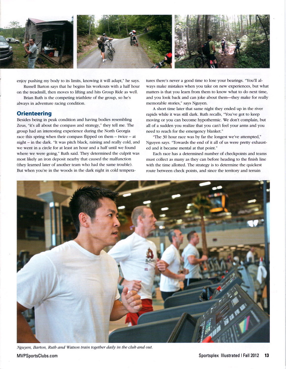
Our training gym, the RDV Sportsplex in Maitland, has published an article about our team and the exhilarating adventures we recalled during an interview. The RDV has six locations in the US (which has over 32,000 members), with the one in Maitland being the previous training grounds for the Orlando Magic. We received honors of the front cover!