Thursday, January 24, 2013

FLO - Little Big Econ

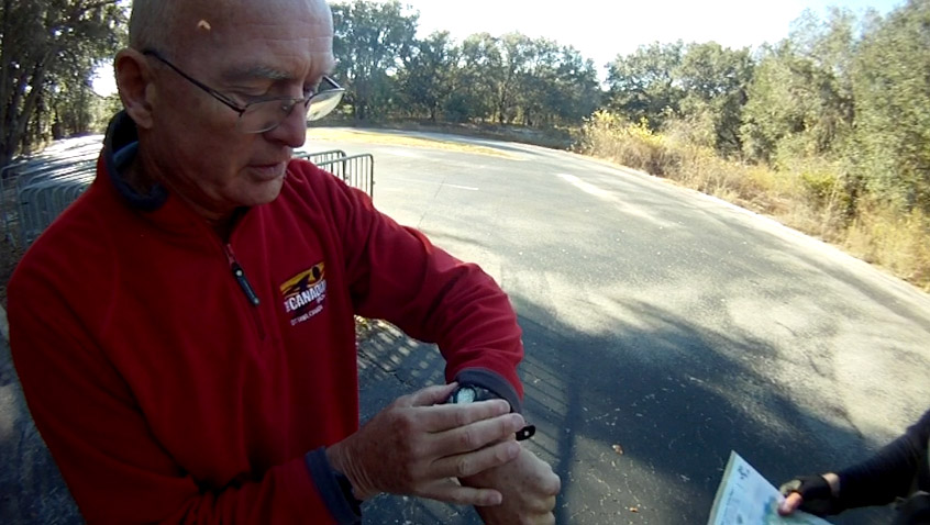
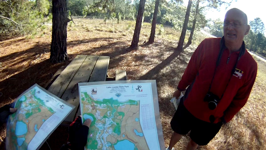
The goal...the Atomic AR.  The agenda...complete two FLO trekking courses with only a map and a compass.  FLO has provided a great learning experience for us to use on our Pangea events.

Red Course


Today we set out with honorary Canyonero, Bill Dean (team We Blame Javan), who will join forces with us for the Atomic AR in May.  This was his first time out on an FLO course.  He was solid, both physically and navigationally.  As a team, we welcomed the hardest Red course to start with.  We worked pretty well, bouncing navigational data off each other and questioning decisions in an effort to keep accurate.  Only one CP had us scratching our heads for a bit, CP8, which was a solid 200m in the middle of a forest.  On map, colored shapes are drawn out to indicate thick forestry and clear running land, but in real life, those lines are blurred, making it a challenge to know where you are.  We eventually found it.

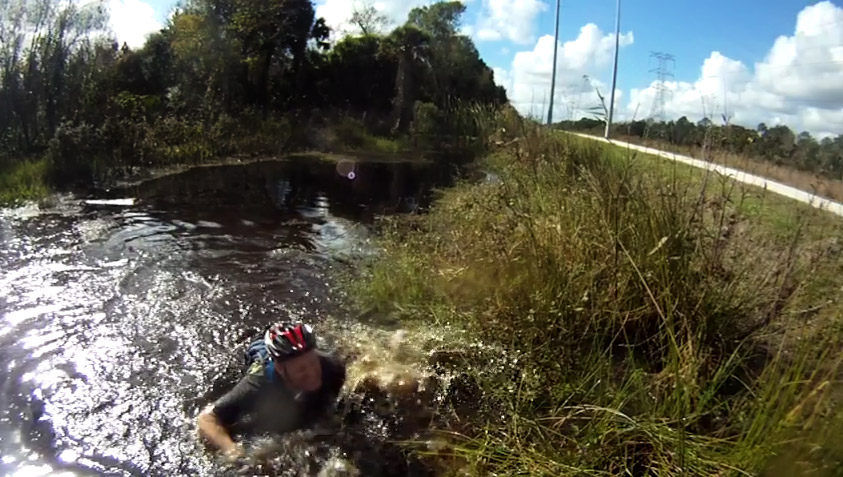
Oh yea...from CP6 to CP7, we tested whether going along the shoreline of the river was faster or heading back on trail.  Bill and Nate ran the trail to the north with no problems.  I volunteered to run along the river, which was much slower.  Along some areas, there was no beach but a cliff, so I plunged into the river.  I showed up about 7minutes after they did.  Note taken--follow the trails if they're pretty close, rather than bushwhack :)

Here's our Red GPS route:
http://www.movescount.com/moves/move10246883

Green Course


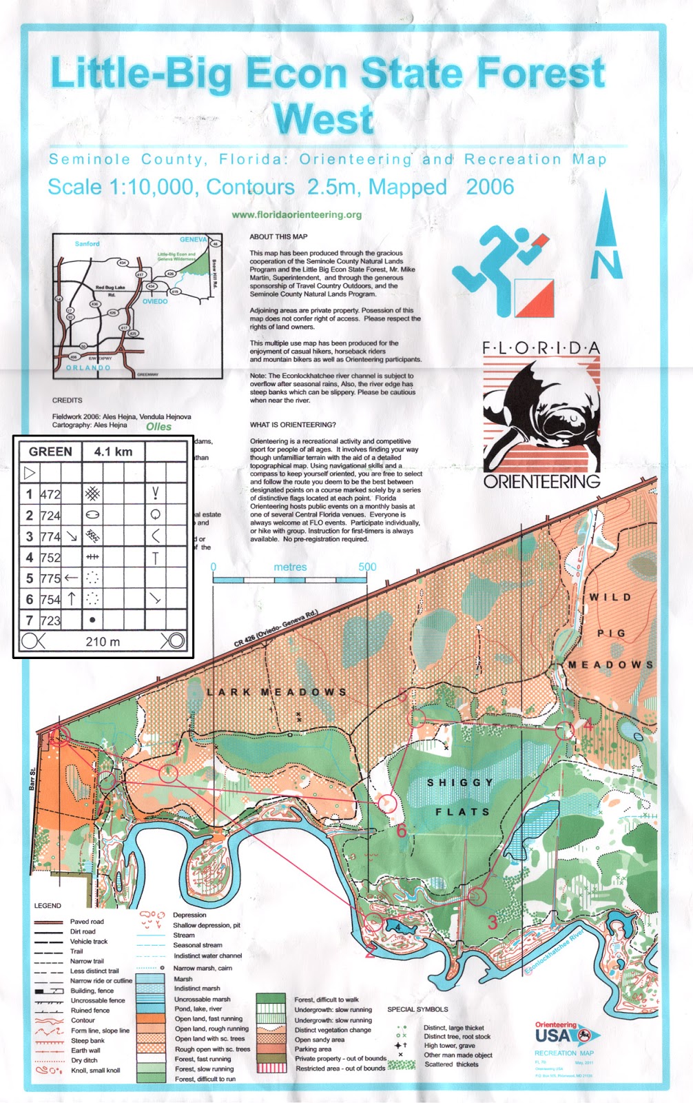
Second on the agenda was to race the 'easier' Green course as individuals, each staggered by 5 minutes.  Nate has been improving on his navigational skills as my backup, and this would be his first time out alone.  Not only that, he beat the teacher, me!  Bill, who kindly admitted Little Big Econ was literally his backyard, beat us all.

Nate's GPS route overlayed on FLO map (blue line)

Nate reported he had an "oh shit, I'm lost" moment heading to CP2.  As seen in the GPS route, he poked into just about every intersection leading down into it, as well as rounded the river :)  Good stuff!

Nate will eventually find it!

Onto CP3, he again had some mishaps.  The first, missing the ditch that led up to the CP and having to backtrack to get on it.  And then the second, going off the the correct trail of the ditch, bushwhacking across a stream, going back on trail and re-attacking to find the 4-way ditch intersection.  But he found it!  A true sign of stubborn Canyonero determination :)

Nate's wild route to CP3

Embarrassingly, I could not find CP1 right off the bat, for the life of me.  I initially attacked in from the intersection at the very beginning, and then attacked in at the bend in the trail up north of the CP, and then attacked up from the trail bend at the south.  I attacked and re-attacked at least 5 times, while spending 20min on this CP alone, before calling it quits with no punch :(  Upon review of Nate's course, the punch was much further east than mapped.  The rest were pretty straight forward for me.  Some of them were repeats of the Red course.

CP1 mapped out of the circle

Nate's Green GPS route:

Bill's Green GPS route:
http://app.strava.com/activities/38553784

All in all, this is shaping up just as I imagined it, leading up into the Atomic AR.  This is looking very positive because there will be mountains to crush in Georgia, navigationally, and physically.  We'll be putting our minds together to figure that one out and to do well.

Monday, January 21, 2013

Pangea - Resolution AR, Elite 8hr

ominous clouds enhancing the effect of our cramps during hour 7

We were all relieved to see forecasts not dip into the 30 degrees F heading into this race (like they were last year).  We've been hitting up the FLO events in an effort to continuously improve, but our bigger goal in mind is the ultimate of races, the Atomic AR in May.


race map and instructions

Trek 1

The race started out with a prologue on foot and then on bike.  We took the route to the north along the beach of Lake Louisa to get to CP1.  We met half of the other racers cutting through the woods for a shorter distance as we neared the roundabout circle near WP1.  Instead of relying on my plan of precisely finding WP1 and then shooting to CP1, we followed the mass crowd into the woods, thinking the chaos would eventually lead us to CP1.  That didn't happen, and not only that, half of our team got separated and we spent 13 minutes shouting and finding them.  CP2 and 3 were easily found with the aid of highly detailed FLO maps.
start of the race

Bike 1

We transitioned into bikes and immediately missed the first right to get on the direct road to CP4.  We did not lose too much time as we took the next right that led us right back on.  We rode to the point where we were immediately south of CP4, attacked directly north and found it.


To get to CP5, I measured 60m from the man-made object on that trail and attacked in.

CP6 was 500m from the intersection before we had to jump into the woods to follow the line of palmettos.

CP7 was in the same spot as another CP in the Bubba Goat race a few weeks earlier.

Canoe

Last year, we paddled through the massive Lake Louisa in frostbiting, choppy waters.  Conditions were so bad that most teams ditched the canoe and ran alongside the lake to gather the CPs.  This year, race director, Manny Otero, put us on a lake that was only about 1km wide.  It takes us about 10minutes to paddle 1km, depending on wind conditions.  In an 8hr race, how do you make the paddling segment last about 1/3 of the race when the lake is only about 1km wide?  ...by having us go back and forth a mind-numbing nine times.  In some places, there were CPs not too far away from each other, ensuring that accurate bearing measurements were critical.


Once we arrived at Dixie TA, we were given a set of instructions to follow.  From the end of the dock, shoot 89* and paddle for 1056m.  It would lead us into the opposite side of the lake.  As sharp of a bearing as I tried to shoot from the end of the dock, there were no CPs to be found once we arrived over.  We took note that there was another CP about 100m to the left of us.  Nate and I convinced ourselves that 100m could be a margin of error, given our 1km paddling distance.  We punched it, noted #58 on the punch to use as a reference for our second CP.  Go for 955m at 196 degrees.

reference sheet

Nate and I both shot bearings on the second one.  Both of us had slightly different markers in the distance, so we decided to split the difference down the middle--a technique we would use for the rest of paddling discipline.  As we headed over this time, we took note that there was a CP about 100m to the right of where we shot it.  Again, we punched it and chalked it up to margin of error.


We referenced #61 at the control point to our legend of instructions, which told us to go 904m at 12 degrees.  The third CP was attached to a branch that was overhanging the water.  This one gave us the least amount of questioning.

shooting bearings into the distance

Reference #34 told us to go 771m @ 212*.  As we got nearer, the CP was just about in the middle of where Nate and I split our bearing shots.  We saw Good'Nuff heading away from the CP after punching it.  This was supposed to be our fourth CP.  Hmm...something wasn't adding up.  Either we were going fast enough to keep up with the 2012 champs, or we were way out of whack.  Well, you can bet it was not the former.  Suspicions started to cloud our thoughts.  There was no way we could have kept up with Good'Nuff.  Regardless, there were no other clear CPs nearby, so we punched it.

crossing paths with Good'Nuff in pink

The next set of instructions had us going 862m @ 48*.  As we headed over, AGAIN, we noted a CP about 150m to the left of where we shot it.  This time we had a hunch that we had already punched that one, so we stuck to our original bearing.  Once we hit shore, we jumped onto land and scouted the area.  No CPs to be found :(  There was nothing left for us to do but go to the control that was 150m to the left of us.  We got there and sure enough, it was the same damn overhanging branch--the same CP two punches ago.  We punched it anyways.  It had the same punch pattern as a previous punch.  This confirmed our screwed up situation.

we saw this overhanging branch twice :(

We had no idea how they were going to score this section.  There were two monstrous bike and foot portions left.  Instead of doing one more iteration of paddling out and back, we decided to call it sooner than later, and end our canoeing now.  If they graded it exactly, we had a chance of receiving zero points.  It was the right decision for our team, so we headed back to the TA.

Bike 2

Florida is "Land of the Sugar Sand," as Greg Owens put it at the race meeting.

Conditions were pretty brutal for biking on this portion, although I still say the Turkey Burn of 2012 was the ultimate of biking brutality.  All CPs on bike were pretty easy for us to find, except that we do not know if our route choice was the absolute quickest way.

We went clockwise on the southern loop and then counter-clockwise on the northern loop.
CP27, 28, 29, 30 and then CP 32, 37, 36, 35, 34, 33, 31.

Greg's battle with palmettos.  He insists he did more damage to the palmettos than they did to him.

At CP34, we were told at the race meeting that there were no trails leading down into it, but there was a trail leading up into it.  I determined that we should stay safe by attacking from the south, but that did not prevent Nate from dipping in from the north side.  We found the mapped lake to attack from, which was pretty weak and low on water level in real life.  Equipped with new FLO skills, he led us into the woods, followed the palmetto border, which got us into the vicinity, but Brian was the one with the hawk eyes, who spotted it a whopping 200m away!


Nate and I wanted to skip the last CP31, as it was the least bang-for-the-buck, but the team voted to clear the bike portion on pride.  There were two areas where I misdirected the team on the wrong trail, but that probably costed us only 10-12 minutes total.

Foot 2

At this point, we had about 2hrs to go and a massive foot section.  Nate is my navigator in training, who's been great to bounce decisions off of.  He calculated that we had to drop several CPs off in order to make the loop around the lake, so right off the bat, we changed our plans to collect CP26, 17, 20, 22, 23, and 25, in that counter-clockwise order, while dropping the four outer-most ones.  This route took us on a loop around a lake, so once you committed, there was no returning until you completely circled the lake.

some cool scenery we didn't stop to enjoy

They were all easy for us to find.  Over the months, we have grown to fully understand the fundamentals of orienteering through Pangea and Florida Orienteering and our sharpshooting this day was showing it.  These would have been pretty difficult for us to locate last year.  During this race, however, we did not ever get the "oh shit, we're lost" moment at any time.  Everything was methodical and kept track of, from distance gauging to time keeping.

On this route, there was a four foot rattlesnake that darted across Greg and Brian's path.

The biggest challenge on this portion was trying to manage our crippling cramps.  It forced us into a mode where we tried jogging for so many minutes, followed by walking and repeating.  At CP20, we still tracked well ahead of the time we had calculated to finish on time, which we did, with 27 minutes to spare.

team Canyoneros - Brian, Hien, Nate, Greg (left to right)

Our GPS route:

Thursday, December 27, 2012

FLO - Bubba Goat (ghost event)

Canyoneros are wanting to have a strong 2013 year, so to keep training, we hit up legendary Gord Hunter.  He was extraordinarily nice enough to have come out of his way to Lake Louisa and given us the recent Bubba Goat maps to run.  Obviously, there would be no punches set out, but to see how accurate we were, he lent us his Garmin Forerunner 405 to confirm our route afterward.

Here are some pics of the 15 mile trail run...

the start

banana spiders are abundant in FL

getting a second map and some racing tips from Gord

very straight trees in this forest

we tried to avoid these seeds by going to CP7 in the shortest bushwhack possible; we were still attacked

biking through this deep sugar sand won't be any faster than trotting through it

one of many lakes at Lake Louisa

rummaging through a clean, open forest

Halfway through the race, we were in a barren world resembling West Texas.  It was scattered with cactus patties.  We caught a few in the foot, but that didn't stop us from running :)

orange groves

you can never avoid having to cut through these palmettos

With the GPS route recorded, Gord overlayed our route onto the race map, showing us missing only one control point, CP3.  You can also see that as we headed to CP4, we made a correction by going a little bit north on the trail to the highest point in elevation, before following the bearing to again.


The route colors indicate the the speeds we achieved through different types of terrain.  This is very interesting information, seeing how a bushwhack through the orange "rough open land" is roughly 1/3 the speed of running on the trails.  That means we can afford to run up to three times the distance to get to the same point, at the same time.  We will definitely use this information for future races.


We skipped CP5, as part of allowed race format, since it seemed like a lot of bushwhacking.  However, on post-race review, we could have followed the red route here to minimize bushwhacking, even with attacking CP6.

Here is our GPS route:
http://connect.garmin.com/activity/254877186

Thanks Gord!  We definitely picked up new racing knowledge.

Saturday, December 15, 2012

Pangea - Christmas in Christmas AR, 3.5hr


Canyoneros set out with six strong and ended with everything that could have happened in a AR race.  Things are still unpredictable for us at times, but that's what creates memorable stories.

Bike

The race started with the bike portion for our two teams.  We led the pack down the dirt road into CP19, doing it in a counter-clockwise fashion, where flashbacks of the Nocturnal race came to me.  This time, there was no hesitation, as the trail was still flooded, but we trucked in like madmen.  Off in our peripheral vision, a gator darted away.  The pack behind us dropped their jaws, gazing down this river of a path, but gained confidence as we showed them the way.

Greg heads over to punch CP19

a race where Sport and Elite teams run together

CP16 was easy to hit, as was 15.  On our way to CP17, one of our original Canyoneros, Russell, underestimated the size of a log and with his new 'Chuck Lennon' skills and Specialized 29er, decided to try to fly over the log at good speed.  It didn't work :) but with the stubbornness we are characterized with, he got up and shouted "YOU DIDN'T GET THAT ON GOPRO?!"  We knew he was in a world of hurt and it slowed him down throughout the race.

one shout is all that's needed for everyone to attack CP15

CP14 and 13 was a matter of going the measured distance and constantly checking the bearing of the route.  We headed back to the Main TA, second, only behind Ron Eaglin's powerhouse team.

Trek

CP1 was a no brainer along the trail.  We got to CP2 after getting veered off course a bit on the trail bend there.  We lost track of the trail markers on the trees, but quickly backtracked to the known creek to find our position again.  Having 6 sets of eyes made things very easy.

race map

CP4 was the first to slow us down noticeably.  We ran a pre-measured distance of 550m from the trail after CP3 to CP4.  However, we all miscounted our paces, so I started looking for a clearing on our left, instead, as mapped on the National Geographic map.  Once we saw Ron poking out of the woods north of us, at that exact area, we knew we couldn't be far.  Again, our six set of eyes found this one.

After that, I made a mistake of completely overlooking CP5, so we attempted to head to CP6.  From CP4, I headed north, hitting the yellow trail, while trying to find a distinct sharp bend in the road (marked A on the map below) that we were to use as an attack point to CP6.  The trails aren't really trails out there, more like ambiguous gaps between trees, so it was tough to determine if you were going around a particular curve or not.  We identified this 'apex' prematurely and headed up the wrong area, where Juan found CP7, instead.  Thinking CP7 was 6, we shot a bearing along the vegetation border and counted paces to a non-existent CP7, in an L shape.  After spending about 15 minutes searching, we went south to the yellow trail to find a different attack point.  Ron trucked by us, again, seeing confused faces, helped us out by pointing out exactly where we were, which we were able to use to find CP8, back to 7, and then 6.  Thanks Ron!

green is the route that we took.  yes, it is very dirty

Our misfortunes in navigating did not end there.  We headed to CP6 using the northern vegetation boundary, but thinking we were on the lower one.  The two had the same bearing. After about 10 minutes searching in the wrong corner, Nate became suspicious of this mistake.  He confirmed with me and we found the oak tree we needed immediately.  Nate is my navigator in training and has been correcting me very often.  We have seen his skills grow in the Florida Orienteering events, and I think he's our next navigator :)


re-grouping to figure out where we are

On the way out, we debated the idea of traveling on the yellow trail to head back before going north on the red trail (blue line below).  Distance-wise, it made better sense to bushwhack north from CP6 to hit the main dirt road (green line below).  We had a couple attempts at bushwhacking north before blazing a trail out.  This bushwhack was a dense, engtangled wall of thorns!  Those of us who did not wear long pants learned a lesson, haha.

which route is quicker?

pushing through walls of brush and thorns

Adding insult to injury, we were met with a swamp at the end of the bushwhack, which turned into a sewage ditch on the side of a road.  The look on their faces was priceless!


Greg Watson, Brian Ruth, Juan Chavez, Nate Whitaker (left to right)

Russell Barton

I got this idea from Ron (in fact, I get all my ideas from Ron)--using a phone GPS tracking app in my backpack to record our route.  Don't worry, we don't cheat, otherwise, we wouldn't have gotten so damn lost.  It's very useful to review the strategies and decisions made at the time, and it's also very funny to see you going in circles when lost!


Canoe

The ride to the Boat TA was 4.5km, hard-packed, which is heaven compared to the trails at last month's Turkey Burn.  However, Barton only had power to one leg.  I've seen him at the gym.  One leg still provides 500ft/lbs of torque!

three canoes setting sail, one was the speedy silver one

We managed to get to the Boat TA with both punch cards missing!  Up til now the strategy of having one guy carry two teams' worth of punch cards worked.  Ah well, we're out having fun with a large Canyonero army.  If that happens to anyone else, use your instructions or map to punch with.  We still got deducted a point for losing a punch, but at least we still got credited for clearing the canoe portion.

looks much different during the day (vs the Nocturnal AR)

let no man be left behind

This race probably had enough events to fill a 30hr race, yet it was only 3.5hrs long.  To recap:
  1. Barton completely flipped over a log, head over heels, landed his thigh on it, and grew a lump the size of a grapefruit.
  2. We got lost badly on a couple CPs.
  3. We completely overlooked one trek CP :(
  4. We trekked through chest deep sewage and thorns.
  5. Both of Brian's legs completely seized on our ride back from the boat TA and got tossed almost into a ditch.  The demonic lumps on his legs were so excruciating, it turned his face blue.
  6. We lost both of our canoe punch cards - one penalty per team.
  7. We came in late - another penalty per team.
  8. Our navigation was flawless on bike and canoe, not so much on trek.
All in all, Canyoneros still get up fuming, but continue on forward, telling tall tales of glory :D